Forest Service Considers Thousands Of Acres For Geothermal Leasing

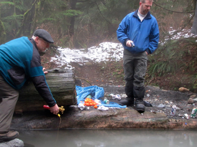
Geologists Dave Tucker (left) and Pete Stelling (right) at the Mount Baker hot springs in Washington's Cascade Mountains. The Forest Service says the springs will not be disturbed, but they are within the large tract of federal land that could one day be open for geothermal development.Ashley Ahearn
Geologists Dave Tucker (left) and Pete Stelling (right) at the Mount Baker hot springs in Washington’s Cascade Mountains. The Forest Service says the springs will not be disturbed, but they are within the large tract of federal land that could one day be open for geothermal development.
Ashley Ahearn


By Ashley Ahearn, KUOW

The volcanic ridges of the Cascades have long been poked and prodded by people who want to know what kind of geothermal energy they’ll find beneath the surface.

But many of the Northwest’s hot spots are on public lands. And in some cases, federal land managers have prevented access by companies seeking to convert that magmatic force into clean electricity.

That could soon change. The U.S. Forest Service is pursuing plans to make more than 80,000 acres in Washington’s Mt. Baker/Snoqualmie National Forest available for lease to energy companies. A final decision on that is expected as early as this month.

Companies wanting to develop geothermal power on federal lands would then undergo a full environmental review for each proposed project. Those studies would take into account the potential seismic risk,  vehicle traffic and transmission lines that could be associated with a geothermal power plant.

The development of geothermal power is under way in some parts of the Northwest, which the industry regards as a new frontier. Within that clean-energy frontier, Mount Baker is an outpost sentinel on its northern edge. Its steaming crater and the hot springs on the mountain’s eastern flanks are drawing attention from would-be geothermal developers.

Using steam from deep beneath the earth’s surface to spin turbines and generate electricity is not a new idea. But as more and more renewable energy comes on line, geothermal delivers in a way that intermittent sources like wind and solar do not: it provides a consistent source of what industry insiders call “baseload” power. That’s appealing to utilities like Snohomish PUD.

“A baseload renewable resource is something to treasure. We view it as a very attractive possibility,” said Adam Lewis with the Snohomish Public Utility District. The district has spent $5 million researching geothermal developments in Washington and is interested in building a traditional geothermal plant in the Mt. Baker/Snoqualmie National Forest to power roughly 20,000 homes.

The Forest Service’s move has raised concerns about negative impacts on natural ecosystems. Fifteen conservation groups have submitted a joint lettercommenting on the service’s proposed lease.

“We should be looking at everything but is this really where we need to be looking and if we are, we need to be real careful going up into wild rivers or intact forests,” said Tom Uniack, Conservation Director for Washington Wild.

The groups pushed for stronger protections on rivers and roadless sections of the forest, as well as certain forested areas that provide old growth habitat for northern spotted owls and marbled murrelets — two bird species that are protected under the Endangered Species Act.

How big is the Northwest’s geothermal potential?

California leads the world in geothermal power generation. Development has also grown in Nevada and Utah, but the Northwest lags behind.

Despite the region’s iconic volcanoes that rise up from the Cascade Range through Oregon and Washington, the geothermal potential in the region varies greatly. In Washington, hot spots appear to be limited to areas immediately surrounding volcanoes like Rainier and Baker.

Less than 5% of the total hydrothermal heat discharge from the Cascades occurs north of latitude 45N, according to research from the US Geological Survey. Less than 5% of the total hydrothermal heat discharge from the Cascades occurs north of latitude 45N, according to research from the US Geological Survey.  USGS

Research from the U.S. Geological Survey shows extensive hydrothermal heat discharge in large stretches of the Cascades in Oregon, an indication of geothermal potential, particularly in the state’s southern and eastern stretches. But those heat signatures drop off as you head north of Mount Jefferson and the Three Sisters peaks.


In Washington, the places that could provide geothermal power appear to be even scarcer. Steve Ingebritsen, a geologist with USGS, found that less than 5 percent of the total hydrothermal heat discharge from the Cascades occurs north of the Oregon/Washington border.

“Maybe that’s because the high rainfall and snowfall and snowmelt and fractures near the surface are allowing the water to percolate down and mask the geothermal indicators we’d be looking for,” said Pete Stelling, a geology professor at Western Washington University in Bellingham. “But we don’t really know. We’re still on the hunt right now.”

The Washington Department of Natural Resources has analyzed temperatures in more than 450 wells around the state and found similar results.


The Washington Department of Natural Resources has analyzed more than 450 wells to chart subterranean temperatures around the state.


But that doesn’t mean it’s game over in the pursuit of geothermal energy in the Evergreen State.

“Although the geothermal potential of Washington is lower than other West Coast states, such as Nevada, Oregon and California, there are still areas of relatively moderate to high potential,” said Dave Norman, state geologist with DNR.

The DNR sampling highlighted hot spots at Mount Baker and the Wind River area as the best places for further geothermal exploration in Washington. (You can look at their mapped well data here.)  There are currently no geothermal electricity generating plants in operation in the state.

In Oregon, geothermal energy provides heat for the city of Klamath Falls but geothermal electrification plants are still few and far between, despite a more extensive geothermal resource than that of Washington. There are two plants in operation – a small one in Klamath Falls at the Oregon Institute of Technology and another 30.1MW facility in Malheur County, which borders Idaho and Nevada.

Seattle-based company, AltaRock is piloting new hydroshearing geothermal technology at the Newberry Crater in Central Oregon, where the Forest Service has already issued a 53,000 acre lease in the Deschutes National Forest.


A scene at Mount Baker Hot Springs, where litter and personal belongings can be found scattered on the ground.
A scene at Mount Baker Hot Springs, where litter and personal belongings can be found scattered on the ground. Ashley Ahearn


Retreating to nature vs. harnessing nature

Orange peels, beer bottles and discarded bras and bathing suits litter the Mount Baker Hot Springs when Dave Tucker, co-director of the Mount Baker Volcano Research Center, and Western Washington University’s Stelling arrive. This area is a hot spot for local college students as well as geothermal energy researchers.

“104.1, 104.3,” Tucker reads temperatures (in degrees Fahrenheit) off his sensor. A broken bottle crunches under his boot. “It’s not, certainly you wouldn’t generate any power from this thing but it’s an indicator that hot water can reach the surface here.”

The springs are within the area of national forest currently under consideration for potential geothermal leasing, though the Forest Service says that any development near the springs would undergo a comprehensive review and the springs would not be disturbed.

The faint rotten egg smell and warm surface temperatures in this pool are enough to interest energy companies and utilities in exploring this area further.

A few hundred yards up the hill from where the geologists scrutinize mineral deposits and algae growth around the murky pool, a tent peeps out of the trees. Four college students groggily make breakfast on their camp stove.

“Does anyone want bacon?” asks Nathan Sundyne, a student at Western Washington University.

Samantha Miller sits in a camp chair nearby.


Samantha Miller and Paul Bikis, students at Western Washington University, enjoy the Mt. Baker hot springs. “I think it’s cool the idea of harnessing natural energy," Miller said, "but if it really compromises the integrity of the area that would be kind of sad.”
Samantha Miller and Paul Bikis, students at Western Washington University, enjoy the Mt. Baker hot springs. I think it’s cool the idea of harnessing natural energy,” Miller said, “but if it really compromises the integrity of the area that would be kind of sad.” Ashley Ahearn


“I think it’s cool, the idea of harnessing natural energy like that,” she says.  “But if it really compromises the integrity of the area that would be kind of sad.”

“Do we destroy the habitat we have, that we get to sit around and enjoy, for energy for more houses and development – growth for the sake of growth?” Paul Bikis, a fellow student asks. “Or do we want to preserve the places that we cherish?”

As Tucker and Stelling hike out of the hot springs area, Stelling pauses to pick up a discarded beer bottle.

“People say ‘no [geothermal development] –  it’s so pretty here,’ and then they leave this mess around,” Stelling said, frustration in his voice. He acknowledges that harnessing geothermal power does come with some local environmental impacts, but he says that we can no longer afford to be “hamstrung” by the “not in my backyard” approach to new clean energy projects.

“If we want to save the environment and be the environmentalists that we hope that we are, then we need to consider what we’re doing on a bigger scale.”

Puget Sound Tribe’s Lawsuit Aims To Keep Oil Trains Off Its Reservation

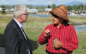
File photo of EPA Region 10 Administrator Dennis McLerran (left) meeting with Swinomish Tribal Council Chairman Brian Cladoosby at the Swinomish Reservation. Cladoosby's tribe has filed a lawsuit to stop oil trains from traveling on its reservation.Ashley Ahearn
File photo of EPA Region 10 Administrator Dennis McLerran (left) meeting with Swinomish Tribal Council Chairman Brian Cladoosby at the Swinomish Reservation. Cladoosby’s tribe has filed a lawsuit to stop oil trains from traveling on its reservation.
Ashley Ahearn


By Ashley Ahearn, KUOW


The Swinomish Tribe has filed a lawsuit against BNSF Railway to stop oil trains from traveling through its reservation.

BNSF train tracks cross the top of the Swinomish Reservation in Skagit County. In recent years they’ve been used to move oil from North Dakota to two refineries in Anacortes.

In 1990 BNSF and the Swinomish reached a settlement that required BNSF to regularly update the tribe on the type of cargo moving through the reservation. It also limited traffic to two 25-car trains per day.

Now, the tribe says BNSF is running several times that many train cars through the reservation each day (an estimated six oil trains of more than 100 cars per week).

The Swinomish Tribe says BNSF does not have permission for the increased oil train traffic and that the company is putting the tribe’s way of life at risk.

“We told BNSF to stop, again and again,” said Swinomish Chairman Brian Cladoosby. “Our signatures were on the agreement with BNSF, so were theirs, and so was the United States. But despite all that, BNSF began running its Bakken oil trains across the Reservation without asking, and without even telling us.”

The lawsuit was filed in U.S. District Court in Seattle. It seeks to stop BNSF Railway from moving oil through the reservation.

BNSF spokesperson Courtney Wallace says the company has received the complaint and is reviewing it.

Wilma Mankiller added to final ballot to place woman on $20 bill

The late Wilma Mankiller was the first woman elected to the position of principal chief of the Cherokee Nation. Photo from All Things Cherokee


Source: Indianz.com

A group called Women on 20s has added the late Wilma Mankiller, the first woman elected to lead the Cherokee Nation, to its final ballot.

The group hopes to convince President Barack Obama to put a woman on the $20 bill. But of the 15 candidates that were named as a replacement for president Andrew Jackson, none represented Indian Country up until now.

“Because of strong public sentiment that people should have the choice of a Native American to replace Andrew Jackson, Cherokee Nation Chief Wilma Mankiller, was added to the final ballot,” the group wrote on its website.

Ginnie Graham, a columnist for The Tulsa World, brought up Mankiller last month and called her the most suitable person for the bill. “A best statement would be to honor a Native American in place of the president who was called ‘Indian Killer,'” she wrote on March 18.

Louise Erdrich, a member of the Turtle Mountain Band of Chippewa Indians, added her voice in a short piece for The New York Times on March 20. “A descendant of the survivors of that cruel march where some 4,000 peaceful people died, Wilma Mankiller led her people with forceful calm,” the award-winning author stated.

Mankiller now joins Harriet Tubman, Eleanor Roosevelt‎ and Rosa Parks‎ as the four finalists. Voting is open on the group’s website.

Orca Baby Boom Hits Puget Sound

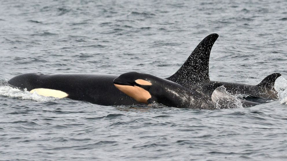
In this photo taken March 30, 2015, and provided by the Pacific Whale Watch Association, a newborn orca whale swims alongside an adult whale, believed to be the mother, in the Salish Sea waters off Galiano Island, British Columbia. Jeanne Hyde/Maya's Legacy Whale Watching/AP Photo
In this photo taken March 30, 2015, and provided by the Pacific Whale Watch Association, a newborn orca whale swims alongside an adult whale, believed to be the mother, in the Salish Sea waters off Galiano Island, British Columbia. Jeanne Hyde/Maya’s Legacy Whale Watching/AP Photo


By PHUONG LE, Associated Press

The endangered population of killer whales that spend time in Washington state waters is experiencing a baby boom with a fourth baby orca documented this winter.

The newborn was spotted Monday by whale-watching crews and a naturalist in the waters of British Columbia, according to the Pacific Whale Watch Association, which represents 29 whale-watching operators in Washington and British Columbia.

The orca was swimming with other members of the J-pod, one of three families of orcas that are protected in Washington and Canada.

Ken Balcomb, a senior scientist with the Center for Whale Research on Friday Harbor, confirmed the birth to The Associated Press on Tuesday. The center keeps the official census of endangered southern resident killer whales for the federal government.

The birth brings the population to 81, still dangerously low. Listed as endangered in 2005, the whales are struggling because of pollution, lack of food and other reasons.

“This one looked quite plump and healthy,” said Balcomb, who reviewed photographs of the newborn. “We’re getting there. We wish all these babies well. They look good.”

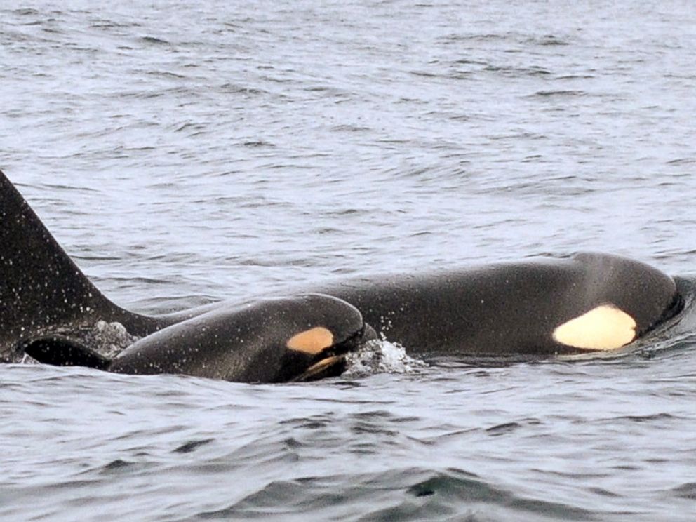
PHOTO: In this Feb. 25, 2015 photo provided by the NOAA, a new baby orca swims alongside an adult whale, believed to be its mother, about 15 miles off the coast of Westport, Wash.

Candice Emmons/NOAA/AP Photo
PHOTO: In this Feb. 25, 2015 photo provided by the NOAA, a new baby orca swims alongside an adult whale, believed to be its mother, about 15 miles off the coast of Westport, Wash.

While he and others hailed the birth of four baby orcas since December, they cautioned that the survival rate for babies is about 50 percent.

“Given where we were four months ago, it’s certainly the trend we’re hoping for,” Brad Hanson, wildlife biologist with NOAA’s Northwest Fisheries Science Center in Seattle, said Tuesday.

“It’s still far too early to think we’re out of the woods yet,” said Hanson, who studies the orcas.

Michael Harris, executive director with the Pacific Whale Watch Association, said, “Who doesn’t love baby orcas, right?” But he, too, urged measured optimism.

“We’re going to keep a careful watch on these babies and our fingers crossed,” he added.

The newest orca was spotted Monday swimming with a calf that was born in December and a female whale. Another calf was born to the J-pod in early February, while a calf in the L-pod was observed in late February.

Balcomb said he thinks the baby’s mother could be J-16, the female whale it was swimming with Monday. But it may be some time before the relationships are sorted out, he added.

Fawn Sharp Discusses Steps to Stemming the Tide of Climate Change

Courtesy Larry Workman/Quinault Nation“Our Mount Anderson glacier is gone. It was there for thousands of years and over the past few years it simply melted. That is warming the water and making salmon restoration more challenging.”
Courtesy Larry Workman/Quinault Nation
“Our Mount Anderson glacier is gone. It was there for thousands of years and over the past few years it simply melted. That is warming the water and making salmon restoration more challenging.”
Richard Walker, Indian Country Today 


Quinault Nation President Fawn Sharp appeared before the House Interior Appropriations Subcommittee in Washington, D.C. on March 24 to request federal funding to support the relocation of homes, public buildings and schools out of a tsunami zone in the coastal village of Taholah.

Sharp’s testimony came a week after the Affiliated Tribes of Northwest Indians, of which she is president, hosted a summit, “Asserting Native Resilience – Protecting and Enhancing Tribal Resources and Sovereignty in the face of Climate Change.”

After her House subcommittee testimony, Sharp – a University of Washington-educated lawyer and former state administrative law judge – talked with ICTMN about the summit and what she believes the next steps must be to stem the tide of climate change and the devastation that would follow.

RELATED: Climate Change: Mankind Must Stop Destroying ‘Our Own Mystical Place’


Quinault Nation President Fawn Sharp, during the 2013 Canoe Journey/Paddle to Quinault: “Climate change is expected to significantly alter the ecology and economy of the Pacific Northwest, and Tribes and Native communities are among the most climate-sensitive groups within this geographic area.” (Richard Walker)


What are some of the extreme examples of climate change that were presented at the meeting?

As we have known for some time, our ocean waters are acidifying due to increased pH levels caused by carbonic acids that result from the release of carbon dioxide into the atmosphere. It’s estimated that up to 40 percent of the carbon released by humans enter the ocean, as well as rivers and lakes.

Generally speaking, there is nothing new about this. But the increased levels of carbon released by humans since the industrial age has had major impacts and, as population has expanded in the U.S. and elsewhere, the increased amount of automobile emissions as well as other fossil fuel emissions have led to ever-increasing change in the form of water temperature increases and acidification.

So should this concern us? It absolutely should, because it is impacting the ecosystem. People should never think they live in some form of protected bubble, or that they can ignore the environment and get along just fine.

People are just as dependent on a healthy ecosystem as every other living creature on Earth, and anytime any specie is in danger, we are affected. But, whether due to fear of losing their job or a feeling of helplessness or some inaccurate information they might have heard somewhere, far too many people do nothing about it. They ignore it or even deny it. That’s just not good enough.

Everyone who lives on our Mother Earth has a responsibility to protect her. Everyone who drinks water in one form or another has a duty to assure it is pure. And every person who breathes God’s air is responsible for its quality.

The ocean is warming. It has become acidified. The sea level is increasing, increasing the intensity of storm surges, as well as flooding, erosion, forest fires and habitat loss. Glaciers have melted or are melting, causing rivers and lakes to warm and making them uninhabitable for fish. We feel all of these impacts at Quinault Nation. Our Mount Anderson glacier is gone. It was there for thousands of years and over the past few years it simply melted. That is warming the water and making salmon restoration more challenging.

What are some innovative ways tribal nations are responding to the challenges presented by climate change?

There are innovative approaches being used or planned by some tribal nations but the bottom line is that Mother Nature’s ways are best. Fish and wildlife need a healthy environment, just as people do. Securing those resources and protecting them for future generations requires respect for the environment. It’s an old tribal value to take only what you need from Nature to survive, and use all that you take. It’s also an old value to base the decisions one makes today on the impacts they will have seven generations from now.

As my very good friend Billy Frank Jr. used to say, “You have got to see the big picture.” Those who rush to drill every drop of oil they can now so they can get as rich as they can, regardless of the impact on the environment, do not see the big picture. Those who neglect the environment when they use pesticides or buy high gas-consumption cars don’t see the big picture. Those who neglect instream flows in their quest for irrigation water or build dams on rivers simply do not see the big picture.

But to answer your question, there are many ways that tribes are being innovative in responding to the climate change problem. This is probably the biggest environmental problem that exists in the world today. So tribes have been gathering, as nations, on a national and international scale to share ideas, consolidate plans and garner strength in their efforts to have a strong voice in their call for the countries of the world to change their ways. We want them to stop poisoning the planet, stop killing all the animals and plants and stop destroying all the habitat. We have been working with the United Nations and other international organizations to achieve the level of recognition the Indigenous Peoples of the world deserve.

We have reached out and been a part of many efforts designed to see solutions to climate change. I served on the Governor’s Carbon Emissions Task Force all summer long as we developed a gas tax plan for the state, which is now being considered in the legislature.

Virtually every tribe in the state is involved at some level in protecting, enhancing or restoring habitat. Quinault has been for many years. Those efforts are constantly innovative in their approach – whether our scientists are developing new ways to place trees in the river to regain natural hydraulics in the system or devising new ways to place gravel for spawning habitat. We invest in our science and in our river, lake and marine restoration and protection programs because it supports our future, it is true to our heritage and because it’s the right thing to do.

(Sharp then shared information about the Swinomish Tribe’s Climate Change Initiative, which can be viewed at here.)

What will ATNI do with the information that was presented at the climate change summit?

ATNI will work with a group of tribal representatives from Pacific Northwest Tribes and Inter-Tribal organizations, in collaboration with federal, state and local governments, to prepare summary recommendations on the following by the next ATNI convention in Warm Springs, Oregon on May 18-21:

One, begin to identify Pacific Northwest Tribal needs for climate change and organize tribes regionally to support increased funding, technical support, and capacity to address those needs.

Two, identify strategies to promote and protect tribal sovereignty and tribal resources.

Three, prepare a strategy to engage Pacific Northwest Tribes on developing a policy framework for a “Pacific Northwest Tribal Action Plan on Climate Change, Energy, and Greenhouse Gas Emissions,” similar to California, Oregon, Washington and British Columbia’s “Pacific Coast Action Plan on Climate Change, Energy, and Greenhouse Gas Emissions.”

Four, coordinate Pacific Northwest Tribes’ actions on climate change into a cohesive and effective strategy in order to inform regional, national, and international policy.

Five, adopt a resolution at ATNI’s May 2015 convention to bring climate change issues, policies, and strategies to the National Congress of American Indians national convention.

In addition to the outcomes of this summit, the Affiliated Tribes of Northwest Indians support the findings of the State, Local, and Tribal Leaders Task Force on Climate Preparedness and Resilience established by Executive Order 136531.

(Sharp then reviewed those recommendations, which can be read at here.)

How are tribal nations seeing the effects of climate change, perhaps in ways that people outside of Indian country are not seeing them?

Climate change is expected to significantly alter the ecology and economy of the Pacific Northwest, and tribes and Native communities are among the most climate-sensitive groups within this geographic area.

Models predict warmer temperatures, more precipitation as rainfall, and decreased snowfall over the next 50 years which will directly affect the abundance of culturally significant foods, such as salmon, deer, root plants, and berries. These foods are important for ceremonies and subsistence, and access to traditional hunting, fishing, and gathering sites is guaranteed by treaty, constitution, or other agreements with the federal government. Increasing the climate resilience of tribal governments and Native communities is critical to ensuring access to resources protected by right and vitally important to the cultural existence and economic vitality of these communities.

Tribes must proactively begin to address these impacts, assess their vulnerability, and develop adaptation strategies. A few Northwest tribes are developing their internal technical, legal, and policy capacity to comprehensively address climate change impacts – however, much more work is needed. Although many tribes have been involved [in] habitat and climate change-related efforts, less than 5 percent of tribal governments – 25 [federally recognized] tribes out of 566 – nationwide have developed climate change vulnerability assessments or adaptation plans.

What action does ATNI want to see taken in order to see some positive impacts immediately?

Funding of Northwest tribes is critical. The principal funding source for Tribal Climate Change is the Bureau of Indian AffairsIn fiscal year 2013, the BIA had only copy million allocated to tribal governments nationwide. In fiscal year 2014, there was to be copy0 million appropriated for Tribal Climate Change programs, however those funds have either been re-appropriated within the Department of the Interior or have not yet reached tribal governments. The ATNI-member tribes are seeking an increase of $50 million for the BIA Climate Change Program for fiscal year 2016 and beyond.

Support is needed for tribes to prepare for the unique impacts they face as a result of climate change. The federal government must fully incorporate its government-to-government relationship with tribes and Alaska Native communities into existing programs and activities that relate to climate change by enhancing self-governance capacity, promoting engagement of state and local governments with tribal communities, and recognizing the role of traditional ecological knowledge in understanding the changing climate.


Read more at http://indiancountrytodaymedianetwork.com/2015/04/01/fawn-sharp-discusses-steps-stemming-tide-climate-change-159826

Father of Marysville-Pilchuck shooter arrested on gun charge

(Photo: Sketch by Peter Millett)


Travis Pittman, KING 5 News

SEATTLE – The gun used by Marsyville-Pilchuck High School shooter Jaylen Fryberg to kill four classmates and himself last year was illegally purchased by his father, according to federal court documents.

Raymond Lee Fryberg, 42, appeared in federal court Tuesday afternoon on unlawful possession of firearms.

Raymond Fryberg was under a permanent protection order from Tulalip Tribal Court after Raymond’s then-girlfriend claimed in 2002 that he had threatened and assaulted her.

In 2012, Raymond pleaded no contest after being charged with violating the order and was sentenced to a year of probation.

As part of the protection order, Raymond was not allowed to purchase firearms. But the court documents reveal that he purchased five firearms from a Cabela’s store in Tulalip, Wash., between January 2013 and July 2014. When he purchased the guns, he falsely indicated on the purchasing agreement that he was not under a protection order.

Investigators at the Marysville-Pilchuck shooting on October 24, 2014, later identified the gun that Jaylen Fryberg used – a Baretta PX4 Storm – as the one of the guns Raymond Fryberg purchased.

Jaylen Fryberg, 15, shot and killed his cousin Andrew Fryberg, 15; Gia Soriano, 14; Shaylee Chuckulnaskit, 14; and Zoe Galasso, 14 inside the school cafeteria. Jaylen also wounded 14-year-old Nate Hatch before turning the gun on himself.

Statement from Marysville superintendent Dr. Becky Berg:

“We are saddened by this morning’s news. Our hearts go out to the victims’ families, our students, staff and community as we continue through the long process of recovery. This is part of an ongoing investigation and all questions related to this matter should be deferred to the FBI.”

Statement from Cabela’s:

“Cabela’s strictly complies with federal, state and local laws regulating the sale of firearms. Cabela’s records indicate the transaction was processed in compliance with applicable regulations, including background checks.”

Statement from Tulalip Tribes Chairman Herman Williams

“The Tulalip Police Department continues to coordinate with federal authorities. It is not our policy to comment on an active investigation and at this time we have no further information to share. Our thoughts and prayers continue to be focused on the victims, their families, and the healing of our communities impacted by the Marysville Pilchuck High School shooting.”

Pollution partially closes nearly 500 acres of Portage Bay shellfish beds

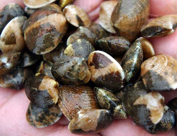
Ralph Solomon holds clams at the sea sea pond on the Lummi Reservation in this 2003 photo, shortly before the tribe reopened shellfish beds that were closed in 1996 due to poor water quality.THE BELLINGHAM HERALD

Ralph Solomon holds clams at the sea sea pond on the Lummi Reservation in this 2003 photo, shortly before the tribe reopened shellfish beds that were closed in 1996 due to poor water quality.
THE BELLINGHAM HERALD


By Kie Relyea, Bellingham Herald


LUMMI RESERVATION — Commercial shellfish harvesting is being banned on nearly 500 acres of Portage Bay for about half the year because of worsening water quality caused by fecal coliform bacteria, the Washington state Department of Health announced Tuesday, March 24.

Portage Bay is home to Lummi Nation’s ceremonial, subsistence and commercial shellfish beds.

State health officials last week changed the classification of nearly 500 of the 1,300 commercial shellfish harvesting acres in the bay from “approved” to “conditionally approved” because of water quality. That means harvesting in the conditionally approved area will be closed each year April through June and again October through December.

Those are the months when tests show the bay is affected by polluted runoff from the Nooksack River carrying higher levels of bacteria into the shellfish harvesting area, the state said.

The partial closure will remain until water quality improves, said Scott Berbells, manager of the growing area section for the department’s Office of Environmental Health and Safety.

The state’s action follows one taken by Lummi Nation in September, when the tribe closed 335 acres in Portage Bay to shellfish harvesting.

The tribe consulted with the state Department of Health and volunteered to do so Sept. 3 after levels exceeded federal standards for commercial shellfish harvest.

Those 335 acres are within the 500 acres downgraded by the state.

“This closure is devastating for the approximately 200 families on the Lummi Reservation who make their living harvesting shellfish,” Lummi Nation Chairman Timothy Ballew II said in a news release.

Fecal coliform bacteria come from human and animal feces. The bacteria enter Whatcom County’s waterways in several ways — horse and cow manure, pet and wildlife waste, and failing septic systems — and indicate there could be pathogens absorbed by the shellfish that may sicken people who eat them.

This isn’t the first time the tribe has closed its shellfish beds in Portage Bay because of fecal coliform pollution. It did so in 1996 because of high levels of fecal coliform in the Nooksack River and streams that empty into Portage Bay.

At that time, the state Department of Ecology and the Environmental Protection Agency led a cleanup plan using state legislation approved in 1998 that required dairy farms to undergo routine inspections and create written plans for how they would contain manure and prevent it from washing into public waterways. Before 1998, dairy farms were inspected only if a complaint was made about a farmer.

Failing septic systems and municipal sewage systems also were addressed.

The effort cleaned up the Nooksack River and its tributaries and allowed 625 acres of tribal shellfish beds to reopen in 2003, and the last 115 acres to reopen three years later.

“During the last 10-year closure, the tribal community lost jobs and millions in revenue. Ultimately, the closure affects all Lummi people because this shellfish area is sacred to our people and critical to our way of life,” Ballew said.

In recent years, the Lummis have expressed concern about water quality once again degrading because cuts to budgets and enforcement created regulatory gaps.

State officials also have been warning about worsening water quality.

“We’ve seen declining water quality in Portage Bay since about 2008. A number of stations have been steadily getting worse,” Barbells said.

Cleanup efforts are once again underway in the watershed.

In 2014, Whatcom County received funding from the EPA to strengthen a locally led effort to identify and clean up pollution sources.

Lummi Natural Resources, Whatcom Conservation District, and the state departments of Health, Agriculture and Ecology are working with Whatcom County and the Portage Bay Shellfish Protection District on the Portage Bay cleanup.

Read more here: http://www.bellinghamherald.com/2015/03/24/4204838_pollution-partially-closes-nearly.html?rh=1#storylink=cpy

Hungry Sea Lions Pile Into The Columbia River

The latest sea lion count in Astoria's East Mooring Basin was a record 2,340, shattering last year's record 1,420.

The latest sea lion count in Astoria’s East Mooring Basin was a record 2,340, shattering last year’s record 1,420. Theresa Tillson/Oregon Department of Fish and Wildlife


by Cassandra Profita OPB


California sea lions are literally piling into Astoria’s East Mooring Basin. They’ve taken over every square foot of the boat docks, and they’re even lying on top of each other for lack of space.

The latest sea lion count in the marina tallied a record 2,340 – a “mind-boggling number,” according to Bryan Wright of the Oregon Department of Fish and Wildlife.

Meanwhile California is seeing starving sea lion pups washing up on shore.

There’s probably a connection there, according to Nate Mantua, research scientist with the National Oceanic and Atmospheric Administration.

Mantua said unusually warm water temperatures in the Pacific stretching from the Gulf of Alaska all the way to Mexico have likely affected the fish seals and sea lions typically eat in the ocean. The population of sardines, one of the staples of their diet, is experiencing a major crash. Meanwhile, millions of smelt returned to the Columbia River this year.

“The male sea lions that migrate up the coast in the spring and winter, they’re probably having a hard time finding food in the usual places where they forage,” he said. “Whereas the lower Columbia River has a relative abundance of food with the smelt run and the early stages of the salmon run.”


Sea lions cover the boat docks in Astoria's East Mooring Basin.Sea lions cover the boat docks in Astoria’s East Mooring Basin. Steve Jeffries, Washington Department of Fish and Wildlife 

Wright said biologists have noticed a jump in sea lion numbers in the lower Columbia River that corresponds with several years of strong smelt runs in the river.

The usual sea lion counts in Astoria’s East Mooring Basin ranged from 100-300. Last year set a record with 1,420 sea lions. This year’s numbers shatter that record.

“It’s doubled and then doubled again and then increased even more, not quite doubling this year,” Wright said. “This year we’ve had a record number of California sea lions in the lower river near Astoria, following on the last two years, which at the time were historic numbers.”

Steve Jeffries, marine mammal biologist with the Washington Department of Fish and Wildlife, photographed a huge group of 6,422 harbor seals at the mouth of the Columbia last month. He said seals also follow the smelt runs, which have been significant the past two years.


More than 6,000 harbor seals were documented near the mouth of the Columbia River at Desdemona Sands.More than 6,000 harbor seals were documented near the mouth of the Columbia River at Desdemona Sands. Steve Jeffries/Washington Department of Fish and Wildlife 

He noted the California sea lion population of around 300,000 “is about as large as it’s ever been,” so changes in food availability are more likely to have an impact. In California, warm water has shifted the sea lions’ food base farther from shore, where females have their pups, he said.

“The females have to forage farther out, and they basically abandon their pups because they have to search farther and longer,” he said. “Their normal prey they eat has been disrupted. So they spend more time foraging and at some point their pups have to nurse.”

Wright said a big question now is how many sea lions will stay in the Columbia River and eat returning spring salmon. Oregon and Washington have authorization to kill some of the sea lions to protect threatened salmon and steelhead at Bonneville Dam.

A new bill sponsored by U.S. Rep. Kurt Schrader, D-Ore., and U.S. Rep. Jaime Herrera Beutler, R-Wash., would allow tribal members to kill sea lions and harbor seals to protect fish.

Interior Department Issues New Fracking Rules For Federal Lands

Interior Secretary Sally Jewell speaks in Anchorage, Alaska. The Obama administration is requiring companies that drill for oil and natural gas on federal lands to disclose chemicals used in hydraulic fracturing operations.Dan Joling, AP
Interior Secretary Sally Jewell speaks in Anchorage, Alaska. The Obama administration is requiring companies that drill for oil and natural gas on federal lands to disclose chemicals used in hydraulic fracturing operations.
Dan Joling, AP

By Scott Neuman, NPR

The Department of the Interior has unveiled new regulations on hydraulic fracturing operations that take place on federal lands, requiring companies using the drilling technique to ensure wells are safe and to disclose chemicals used in the process.

The rules change follows a more than three-year review process and will affect the 90 percent of oil and gas wells on federal lands that now use so-called fracking to extract oil and gas.

“Current federal well-drilling regulations are more than 30 years old and they simply have not kept pace with the technical complexities of today’s hydraulic fracturing operations,” Interior Secretary Sally Jewell said.

Key provisions of the new rules, set to go into effect in 90 days, include:

— Requiring strong cement barriers between the well and any water zones it passes through.

— Requiring companies to publicly disclose chemicals used in hydraulic fracturing to the Bureau of Land Management through the website FracFocus, within 30 days of completing fracturing operations.

— Stricter storage protocols for recovered waste water used in fracking.

— Measures to lower the risk of cross-contamination from fracking chemicals by requiring companies to submit detailed information on the geology, depth and locations of wells that already exist.

“This rule will protect public health and the environment during and after hydraulic fracturing operations at a modest cost while both respecting the work previously done by the industry, the states and the tribes and promoting the adoption of more protective standards across the country,” said Assistant Secretary for Land and Minerals Management Janice Schneider.

The Associated Press writes:


“The rule has been under consideration for more than three years, drawing criticism from the oil and gas industry and environmental groups. The industry fears the regulation could hinder the drilling boom, while some environmental groups worry that it could allow unsafe drilling techniques to pollute groundwater.

“The final rule hews closely to a draft that has been lingering since the Obama administration proposed it in May 2013. The rule relies on an online database used by at least 16 states to track the chemicals used in fracking operations.”

Depaving Cities, Undamming Rivers—Here’s How We’re Undoing the Damage

All around the United States, people are stepping up to help a damaged planet heal.

Remains of the Glines Canyon Dam on the upper Elwha River. Photo by James Wengler.


By Diane Brooks, Yes! Magazine

Releasing the rivers

The largest dam-removal project in history reached completion last fall, when excavators dredged the final tons of pulverized concrete from the Elwha River channel in Western Washington. Native fish, banished for 100 years from their historic spawning habitat, already were rediscovering the Elwha’s newly accessible upper stretches. Within weeks of the final explosion in August, threatened bull trout and chinook salmon were spotted migrating beyond the rubble.

“It was a thrill,” said Olympic National Park spokeswoman Barb Maynes. Before the Elwha Dam was built in 1910, the river produced an estimated 400,000 fingerlings per year, a number that dwindled to 3,000 in recent decades. All five native species of Elwha salmon are expected to repopulate the river.

More than 80,000 dams more than six feet high block U.S. waterways, and activists are cheered by the Elwha success story. Two hydroelectric dams once blocked the Elwha; both now are gone. Sediment that was trapped behind them is washing downstream, replenishing habitat. The first 67,000 seedlings (of a planned 350,000) to help restore native vegetation are already planted on the sites of the former dams and reservoirs. A documentary about the project, Return of the River, came out in 2014.


 Photo by Shutterstock.

Botanical remedies

Headache or back pain? Before you reach for the bottle of aspirin, consider aspirin’s ancient precursor: white willow bark. Or perhaps echinacea to boost the immune system, aloe vera to heal burns, and black cohosh to ease hot flashes.

The trend away from the profit-based pharmaceutical industry toward natural, age-old botanical remedies is beneficial for the environment and wildlife as well as for the humans who take medications. A U.S. Geological Survey study found chemicals from prescription drugs and over-the-counter medications in 80 percent of water samples drawn from streams in 30 states; those waters flow into lakes, rivers, and eventually the oceans.

Alain Touwaide, co-founder of the Institute for the Preservation of Medical Traditions, says pharmaceutical chemists have inverted humanity’s relationship with medicines. “When a sick person used a plant, this person relied on history, the use of the plant over centuries,” he says. Now a researcher starts with a chemical and then experiments to find its uses. Botanical medicine has “an almost philosophical component,” he says, which helps with healing. Users tap into an interactive “sympathy” between humans and the environment, he says.


 Photo by Paul Dunn.

Citizen turtle remedies

When a community of threatened Hawaiian green sea turtles began hauling themselves from the ocean onto the northern beaches of Oahu to bask and sleep in the sunshine, word soon spread through the island’s tourism industry. Families began plopping children on turtles’ backs for photos and poking, prodding, and pushing turtles back into the surf.

Concerned, the national Oceanic and atmospheric administration (NOAA) launched a “Show Turtles Aloha” campaign in 2005. North Shore residents quickly joined in, and in 2007 they created the nonprofit Malama na Honu (Protect the Turtles) to monitor the beach and educate visitors every day of the year. About 60 trained Honu Guardian volunteers take turns patrolling Laniakea Beach, working three-hour daylight shifts. They educate tourists about the ancient species, ask beachgoers to keep a respectful distance, and collect data for NOAA.

Hawaiian green turtles were listed as a threatened species under the Endangered Species Act in 1978. They’ve made a remarkable recovery since then, and their major nesting beach at French Frigate Shoals was added to the Papahānaumokuākea Marine National Monument in 2006. The number of nesting turtles has grown annually from 67 in the early 1980s to more than 800 today, according to Irene Kelly, NOAA’s regional sea turtle recovery coordinator.


 Dennis McClung stands inside what used to be a swimming pool in his backyard in Mesa, Arizona. Now it serves as a closed-loop food-producing farm for his family. Photo by Laura Segall.

Swimming pool becomes backyard farm

It’s a typical Mesa, Arizona, suburban subdivision, except for that corner house with a broccoli patch growing on its low-pitched roof. And those goats, chickens, and ducks roaming the backyard, near the solar panels erected above the entryway to that greenhouse planted in the deep end of an old swimming pool. When Dennis and Danielle McClung bought their ‘60s-era home in 2009, they hatched an eccentric but modest plan to make the best of that decrepit, way-past-its-prime pool. Two days after they moved in, Dennis McClung erected his first in-pool greenhouse, intended to provide food for their young family. He had recently quit his job as a Home Depot department manager; his wife was a nurse. “I convinced my wife of my crazy plan, and she went with it,” he says. “We really wanted to live a more sustainable, self-sufficient life, and we thought this was good idea. And it just kept getting better and better, the more we put into it.”

Today their backyard is a mini-ecosystem—McClung calls it a “closed-loop food-producing urban greenhouse”—and their home is headquarters for the Garden Pool nonprofit organization. Its official aim: sustainable food production, research, and education. At night the chickens roost above the pool’s deep-end rainwater pond so their droppings contribute to an aquaponics habitat for tilapia fish. The McClung’s natural water filtration system uses duckweed and solar energy; their organic greenhouse plants are rooted hydroponically, without soil. Pond snails, which probably hitchhiked in on the duckweed, provide calcium for the egg-laying chickens and help manage a pond-sludge problem.

On a typical day, the system provides the couple and their three children with about half their diet, McClung says. That includes veggies and herbs from the greenhouse; apples, citrus fruit, figs, sugar cane, bananas, and pomegranates picked from a 40-tree grove in their side yard; along with eggs and goat milk.


Making room for carnivores

When gray wolves were reintroduced to Yellowstone National Park in the mid-1990s, we learned valuable lessons about the critical role of large carnivores in balancing an ecosystem. The impact on the landscape was dramatic. Two decades later, stream banks stripped by booming populations of deer and elk are growing new trees and shrubs, and birds and beavers are returning to the feast. Even the physical landscape has been altered, as returning vegetation stabilizes banks and prevents erosion.

Now a growing movement of scientists and conservationists is campaigning to go further to ensure the health and survival of large carnivores: defining and protecting ancient migration corridors across the continent. a key component of this campaign is educating affected communities about the importance—and practicality—of coexisting with species that traditionally were feared and killed.

In her new book The Carnivore Way: A Transboundary Conservation Vision, Cristina Eisenberg says coexistence with wild predators isn’t just possible: it’s critical. “Carnivores protect biodiversity, which creates ecosystems more resilient to climate change. The climate change crisis we are facing makes it critical for us to help carnivores thrive wherever we can,” says Eisenberg, lead scientist at Earthwatch Institute.

The Wildlands Network has identified two initial priorities for protection. The Eastern Wildway runs 2,500 miles from Florida’s Everglades through the forests of Alabama and along the Appalachian Mountains to the boreal forests and Maritime Provinces of Canada. The Western Wildway is a 5,000-mile corridor stretching from Mexico’s Sierra Madre Occidental to Alaska’s Brooks Range, running along the Rocky Mountains.


 Photo from Depave.

Asphalt, be gone

Across the nation, activists are organizing work parties to rip up excess pavement in playgrounds, parking lots, and empty lots, replacing it with pervious surfaces such as porous asphalt, block pavers, and greenery of all sorts. The swaths of impervious pavement that characterize our urban and suburban communities, from sprawling shopping malls to ubiquitous cul-de-sac neighborhoods, have vast ecological impacts. Rainwater—which otherwise would soak into the earth and benefit the habitat—is polluted with oil, antifreeze, and pesticides and then diverted into local streams and rivers.

The Portland, Oregon, nonprofit Depave promotes the transformation of over-paved places, such as schools, while engaging and inspiring communities to reconnect urban landscapes to nature. The organization uses community partnerships and volunteer power, and creates educational events, to pursue its goal of nurturing livable cities where people and wildlife can coexist. Since its initial project in 2008, Depave has transformed more than 123,000 square feet of asphalt, diverting about 2.9 million gallons of stormwater from storm drains. Above, the Creston School depaving project last fall.


 Photo from Rebuild by Design.

Rebuild smarter

The devastation wrought in 2012 by Hurricane Sandy, including 117 U.S. deaths and an estimated $5 billion in damages to greater New York alone, shocked planners and policymakers into fashioning innovative new tactics to protect communities from future disasters. Rebuild by Design, a unique public-private partnership, is identifying and funding ambitious, creative infrastructure improvements in New York, New Jersey, and Connecticut. A contest initiated by the U.S. government already has allotted $930 million to six winning projects, each crafted with powerful community input.

“Sandy exposed physical and social vulnerabilities of the region. It was not built to withstand the forces of climate change, and now we can rebuild it with better foresight,” said Amy Chester, Rebuild by Design’s managing director.

Major philanthropic partners staffed the U.S. Department of Housing and Urban Development contest, and the project is funded by Congress, along with the Rockefeller Foundation and other private supporters. Design teams worked closely with local residents, businesses, and governments to codesign realistic solutions that carry broad support, Chester said.

In Manhattan, for instance, the community examined how river berms can benefit daily public life. “A wall can be a piece of art; a wall can be a part of a park. A wall should never be something that walls off the communities from the waterfront,” said Chester. One winning proposal: the Big U river fortifications. A 10-mile stretch of Lower Manhattan is to be protected from future storms and rising sea levels with projects including wide, grass-topped berms and rolling hills and bridges, providing new recreational spaces along the Hudson and East rivers.