By Manuela Picq, June 2, 2014. Source: Intercontinental Cry
Indigeneity is an unusual way to think about International Relations (IR). Most studies of world politics ignore Indigenous perspectives, which are rarely treated as relevant to thinking about the international (Shaw 2008; Beier 2009). Yet Indigenous peoples are engaging in world politics with a dynamism and creativity that defies the silences of our discipline (Morgan 2011). In Latin America, Indigenous politics has gained international legitimacy, influencing policy for over two decades (Cott 2008; Madrid 2012). Now, Indigenous political movements are focused on resisting extractive projects on autonomous territory from the Arctic to the Amazon (Banerjee 2012; Sawyer and Gómez 2012). Resistance has led to large mobilized protests, invoked international law, and enabled alternative mechanisms of authority. In response, governments have been busy criminalizing Indigenous claims to consultation that challenge extractive models of development. Indigenous opposition to extractivism ultimately promotes self-determination rights, questioning the states’ authority over land by placing its sovereignty into historical context. In that sense, Indigeneity is a valuable approach to understanding world politics as much as it is a critical concept to move beyond state-centrism in the study of IR.
The Consolidation of Indigenous Resistance against Extractivism
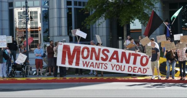
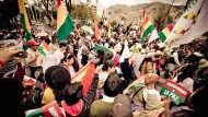
Indigenous peoples are contesting extractive projects in various, complementary ways. Collective marches have multiplied as an immediate means of resistance throughout the Americas. In 2012, the Confederation of Indigenous Nationalities of Ecuador led thousands of people on a 15-day, 400-mile March for Life, Water, and the Dignity of Peoples, demanding a new water law, the end of open-pit mining, and a stop to the expansion of oil concessions. Within days, a similar mobilization took over Guatemala City. The Indigenous, Peasant, and Popular March in Defense of Mother Earth covered 212 kilometers to enter the capital with nearly 15,000 people protesting mining concessions, hydroelectric plants, and evictions. In Bolivia, various marches demanded consultation as the government prepared to build a highway within the Indigenous Territory and National Park Isidoro Sécure (TIPNIS). From Canada’s Idle No More movement to the protests against damming the Xingú River Basin in Brazil, Indigenous movements are rising and demanding they be allowed to participate in decisions affecting their territories.
Protests are at the core of global Indigenous agendas. In 2013, the Fifth Continental Summit of Indigenous Peoples of the Abya Yala encouraged communities to step-up resistance in light of the threat posed by state-sponsored extractivism. This is what Indigenous women were doing when they walked from Amazon territories to Quito, Ecuador, denouncing government plans to drill without consultation in the Yasuní reserve. Local protests are not trivial or irrelevant in world politics. Rather, they are part of a larger effort to transform local concerns into international politics.
Indigenous peoples have remarkable expertise in international law and are savvily leveraging their rights to consultation and self-determination guaranteed in the ILO Convention 169 (1989) and the United Nations Declaration on the Rights of Indigenous Peoples (UNDRIP) (UN General Assembly 2008). They have won emblematic legal battles at the Inter-American Court of Human Rights (IACHR), at times obliging states to recognize Indigenous territorial authority. In the decade-long case of Sarayaku v. Ecuador, the IACHR upheld the right of free, prior, and informed consent with a binding sentence against the Ecuadoran State for allowing a foreign oil company to encroach on ancestral lands without consultation during the 1990s. A 2011 petition by communities of the Xingú River basin led the IACHR to order Brazil’s government to halt the construction of the Belo Monte Dam. The Mayan Q’eqchi’ expanded jurisdiction by taking Hudbay Minerals to Court in Canada for crimes committed at an open-pit nickel mine in Guatemala. In Canada, two Manitoba First Nations used their own legal systems in 2013 to serve eviction notices to mining companies operating illegally on their land.1
International pressure is significant, yet states frequently eschew what they perceive to be uncomfortable mechanisms of accountability. Courts may validate Indigenous resistance, and UN reports warn against the catastrophic impact of extractive industries, but Brazil continued to build the Belo Monte Dam and Peru’s government did not consider suspending the Camisea gas project of drilling 18 wells on protected territories that have been home to Amazonian peoples in voluntary isolation (Feather 2014). Nevertheless, states that evade prior consultation obligations only foster Indigenous inventiveness. In the absence of official mechanisms of consultation, people establish autonomous ones. Local communities of the Kimsacocha area took matters in their own hands after years of being ignored, demanding Ecuador’s government consult them on a mining project in the highlands. In 2011, they organized a community-based consultation without the authorization of the state that was nevertheless legitimized by the presence of international observers (Guartambel 2012). The community voted 93% in favour of defending water rights and against mining in the area. Autonomous forms of prior consultation are increasingly common in Latin America. In Guatemala alone, there have been over sixty community-based consultations since 2005 (MacLeod and Pérez 2013).
Contesting States of Extraction
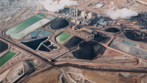
Indigenous resistance has been the target of severe government repression, ranging from judicial intimidation to assassinations of activists. Mobilizations against the Congo mine in Cajamarca, Peru, led President Ollanta Humala to declare a state of emergency and unleash military repression. An estimated 200 activists were killed in Peru between 2006 and 2011 for resisting extractivism (Zibechi 2013). Colombia’s government, in turn, declared protests against the mining industry illegal. In Ecuador, about 200 people have been criminalized for contesting the corporatization of natural resources. Many have been charged with terrorism. Violent repression against TIPNIS protesters in Bolivia revealed that even Evo Morales, Latin America’s first elected Indigenous president, is willing to use force to silence demands for consultation. Various activists opposing the multinational mining giant AngloGlod Ashanti have been assassinated. Argentina’s Plurinational Indigenous Council, which calls for an end to extractivism, has recorded eleven assassinations since 2010. The Observatory of Mining Conflicts in Latin America (OCMAL) estimates there are currently 195 active conflicts due to large-scale mining. Peru and Chile lead the list with 34 and 33 conflicts respectively, followed by Mexico with 28, Argentina with 26, Brazil with 20, and Colombia with 12. Mega-mining alone affects nearly 300 communities, many of which are located on Indigenous territories.
This wave of intense criminalization indicates the expansion of the extractive frontier. In Peru, where anti-extractivist unrest toppled two cabinets under the Humala government and led to the militarization of several provinces, mineral exploration expenditures increased tenfold in a decade. In 2002, 7.5 million hectares of land had been granted to mining companies; by 2012 the figure jumped to almost 26 million hectares, or 20% of the country’s land. Nearly 60% of the province of Apurímac has been granted to mining companies. In Colombia, about 40% of land is licensed to, or being solicited by, multinational companies for mineral and crude mining projects (Peace Brigades International 2011). According to OCMAL, 25% of the Chile’s territory was under exploration or operation as of 2010. In 2013, Mexico’s government opened the state-controlled energy sector to foreign investment, changing legislation to allow private multinationals to prospect for the country’s oil and natural gas resources for the first time since 1938.
The problem is that governments are largely licensing Indigenous land. In 2010, the UN Permanent Forum on Indigenous Issues reported that Colombian mining concessions had been awarded in 80% of the country’s legally recognized Indigenous territories. Colombia’s government has 8.8 million hectares of Indigenous reserves designated as oil areas and granted 168 mining licenses on Indigenous reserves in 2011. Extractive industries lead to evictions, toxic waste, and resource scarcity, creating conflicts over water, soil, and subsoil. Open-pit mining uses unsustainable amounts of water. The controversial Marlin mine, partly funded by the World Bank in 2004, and today fully owned by Goldcorp, uses in one hour the water that a local family uses over 22 years (Van de Sandt 2009).2 In Chile, mining consumes 37% of the electricity produced in the country – which will reach 50% in a few years – compared to 28% for industry and 16% for the residential sector. This requires the Chilean State to continually expand energy sources, thereby accelerating displacement and the transfer of agricultural land to hydroelectric projects.
Conflicts against extractivism should not be dismissed as only concerning Indigenous peoples. They encompass larger debates about the role of extractivism in politics and contest a development model based on the corporatization of natural resources. In particular, they reveal the continuous role of resource exploitation as a strategy to finance states. Governments are prioritizing extractive industries as key engines of growth, although there is ample evidence that extractive industries create relatively few jobs. President Juan Manuel Santos promised to turn Colombia into a mining powerhouse because it attracts quick investment. Opening Ecuador to mega-mining financed much of President Correa’s third re-election. In fact, his unexpected policy shift to approve drilling within the Yasuní Reserve is explained largely by his government’s urgent need for cash. China, which holds over 35% of Ecuador’s foreign debt and financed 12% of its budget in 2013, buys about 60% of the country’s oil and is expected to pre-buy Yasuní oil (Guevara 2013).
Indigenous claims against extractive projects contest a world system based on predation and usurpation. In Guatemala, mining is managed by long-standing political elites and inscribed in the colonial genealogy of power. In many instances, the entrepreneurs promoting mining today are the scions of the same oligarchical families that have controlled Indigenous land and peoples for centuries (Casaús 2007). The political economy of extractivism encompasses global inequalities of exploitation, within and among states. About 75% of the world’s mining companies are registered in Canada, and most operate in the so-called Global South (Deneault et al. 2012). Extractive industries in the North rely on alliances with national elites to exploit natural resources of peoples and places historically marginalized from power politics.
Indigeneity as a Way to Rethink International Relations
Claims against extractivism are ultimately claims to the right of self-determination. The unilateral expropriation of land for mining today is a continuation of the Doctrine of Discovery. It conceptualized the New World as terra nullis, authorizing colonial powers to conquer and exploit land in the Americas. It also paved the way for a paradigm of domination that outlasted colonial times to evolve into a broader – and more resilient – self-arrogated right of intervention embodied by the modern state (Wallerstein 2006). Today, the idea of “empty” lands survives in extractivist practices. Large-scale mining by multinational corporations perpetuates the human abuse and resource appropriation initiated by Spanish colonizers centuries ago in the Bolivian mines of Potosi. International rights to self-determination may have replaced Papal Bulls, yet the political economy of looting natural resources on Indigenous lands continues, now in the name of development.
In this context, Indigeneity is a privileged site for the study of international relations. First and foremost, the extent and sophistication of Indigenous political praxis is relevant to any explanation of world politics. The rise of anti-extractivism as a politics of contestation against state exploitation calls for alternative sites of governance, such as the Inuit Circumpolar Council (Shadian 2013). Indigenous claims are shaping political practice, framing international legislation, and destabilizing assumptions about stateness. They seek the redistribution of rights as much as the uprooting of the concentration of power in the state. In that sense, Indigenous claims to consultation challenge the authority of states over natural resources as much as Westphalian forms of sovereignty.
Second, Indigeneity disrupts state sovereignty (Ryser 2012). The UNDRIP became the longest and most hotly debated human rights instrument in UN history because the expansion of Indigenous rights is intrinsically related to issues of state authority over territory. Rights to self-determination entail the recognition of plural forms of territorial authority in competition with states. Indigeneity is attributed to peoples who have historically been excluded from projects of state-making. Yet it contributes much more than making visible historically excluded groups. It refers to a politics that both precedes the state and lies outside of it. It is the constitutive “other” of the modern state, marked by a co-constitutive history that explains why Indigenous politics vary depending on different processes of state-formation. Consequently, Indigeneity is vital to a discipline dedicated to studying relations among states precisely because it is intrinsically related to state-formation. Standing outside of, and prior to, the state makes Indigenous standpoints valuable in terms of thinking critically about world politics and imagining what post-national political assemblages may look like (Sassen 2008).
Finally, Indigeneity is a strategic perspective in expanding scholarly debates on what constitutes IR. Indigenous experiences complement and broaden official national histories with forgotten or repressed narratives (O’Brien 2010), thus expanding methodological assumptions on how to do IR (Jackson 2010). Its precedence over the modern state encompasses alternative worldviews to think about the international beyond stateness. Indigeneity thus defies core epistemological foundations about power. In particular, it historicizes the state and sovereignty, moving away from Eurocentric conceptions of the world (Hobson 2012) and breaking with the discipline’s unreflective tendencies (Tickner 2013). The vibrancy of Indigenous struggles not only confirms the inadequacy of the state, echoing calls to provincialize Europe’s political legacies (Chakrabarty 2000), but it also provides concrete experiences of what the international can actually look like within and beyond the state (Tickner and Blaney 2013). Indigeneity is therefore doubly valuable for world politics. In addition to contributing alternative praxis of the international, it instigates critical theory to expand disciplinary borders.
Conclusion
Indigeneity is a valuable category of analysis for world politics. Indigenous experiences offer a fuller understanding of the world we live in. Integrating indigenous perspectives in the study of IR speaks to the ability to extend our political practice beyond the ivory tower. It is not a category of analysis that concerns merely Indigenous peoples, just as racism is not a matter for people of African descent only, or post-colonial studies the domain of previously colonized societies. The entire thrust of Indigeneity is that the non-state is the business of the state, and that there are alternative pathways available to decolonize the discipline.
Stripping IR of its state-centrism invites us to reflect upon the entrenched colonialism of international relations. Indigenous perspectives will hopefully inspire scholars to adventure beyond the conventional borders of the discipline. After all, opening an alternative locus of authority is nothing short of revolutionary.