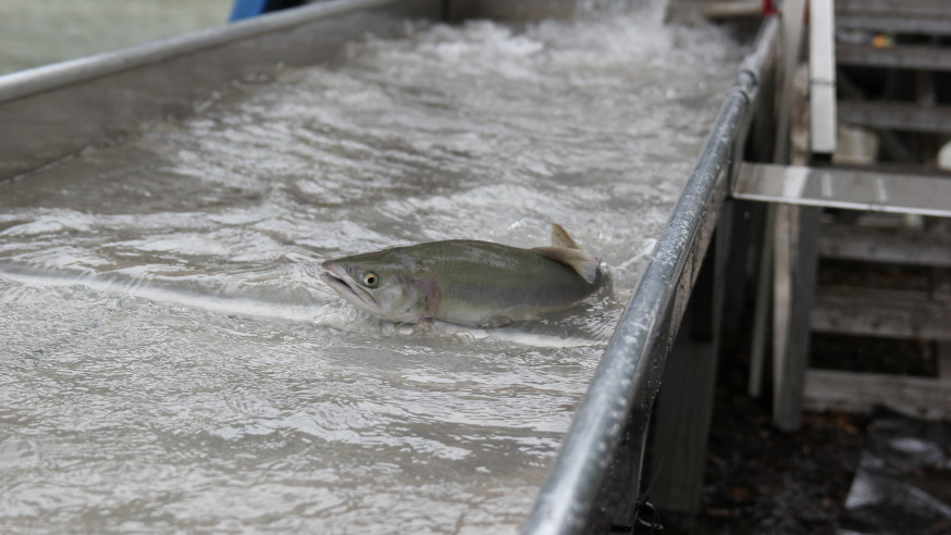
Chinook born in the Nisqually River are being taken into protective custody by the Nisqually Indian Tribe.
The tribe is trapping and spawning natural-origin chinook this fall because so few have returned in recent years. Instead of passing naturally produced chinook above a tribally operated weir, the tribe will truck them to its nearby Kalama Creek Hatchery.
“We’re seeing a sharp decline of natural-origin chinook returning to the river, so we want to make sure these fish are as successful as they can be,” said David Troutt, natural resources director for the tribe.
At Kalama Creek, the fish are being spawned by hand. Their offspring will be released into the river next spring.
To make sure some chinook spawn in the wild, the tribe will release up to 600 adult hatchery-produced chinook into the upper watershed. That way, even more naturally produced chinook will leave the river next year.
“The genetic difference between natural and hatchery-origin chinook on the Nisqually is small,” Troutt said. All of the chinook in the river are descendants from an imported hatchery stock planted decades ago.
The native chinook stock was killed off in the 1960s in large part due to poor hydroelectric practices that left the river dry for months at a time.
Five years ago, the tribe began closely managing the mix of natural and hatchery-spawned fish in the river to help mitigate hatchery influence on the stock.
“Our goal is to let the natural habitat, instead of the hatchery environment, drive adaptation of the stock,” Troutt said. “By mixing in natural-origin fish at the hatchery, we bring in better genetic traits to improve salmon productivity. This means more fish for everyone.”
Recent declines in chinook productivity because of poor ocean conditions drove this year’s drastic action. “Instead of bringing in just a few, we need to bring in every single natural fish we can to protect them,” Troutt said.
Once again denying tribal treaty-reserved fishing rights – and the many federal court rulings that have consistently upheld those rights – the state of Washington is appealing its latest defeat in a case brought by western Washington tribes in 2001 to force repair of hundreds of salmon-blocking culverts under state roads.
Oral arguments for the appeal will be heard tomorrow, October 16 in the Ninth Circuit Court of Appeals in Seattle. The appeal stems from a 2013 ruling by Judge Ricardo Martinez, who issued a permanent injunction requiring the state to repair more than 800 state-owned fish-blocking culverts over the next 15 years. Also at issue is a 2007 decision in favor of the tribes in which Martinez ruled the state’s obligation to fix culverts stems from the treaty right to take fish. The tribes, state, and federal government tried for several years to settle the case, but were unable to reach agreement.
“Our treaty-reserved right to harvest salmon includes the right to have those salmon protected so that they are available for harvest, not only by the tribes, but by everyone,” said Lorraine Loomis, chair of the Northwest Indian Fisheries Commission. “Our treaty rights are at risk because we are losing salmon habitat faster than it can be restored. Without habitat, we have no fish. If we have no fish, we have lost our treaty right, and our culture and economies will be destroyed.”
Tribes reserved the right to harvest salmon in treaties with the United States government more than 150 years ago, in exchange for which the tribes ceded the vast majority of their homeland to allow non-Indian settlement. The treaty fishing right was upheld in U.S. v. Washington, the 1974 ruling that recognized the tribal right to half of the harvestable salmon returning to state waters and established the tribes as co-managers of the resource with the state.
In great part due to loss of habitat, salmon populations have rapidly and continually declined for the past several decades. As a result, both Indian and non-Indian fishermen have suffered from greatly reduced harvests. “We all stand to lose if we cannot protect the salmon’s habitat,” said Loomis. “We were disappointed by the state’s choice to appeal the district court’s decision, especially when restoring salmon benefits Indians and non-Indians alike.”
Blocking culverts deny salmon access to over a thousand miles of good habitat in western Washington streams, affecting the fish in all stages of their life cycle and reducing the number of adult salmon returning to the state by hundreds of thousands of fish. State agencies have consistently told the Legislature that fixing problem culverts is a scientifically sound, cost effective method for increasing natural salmon production. Even so, the state’s sluggish rate of culvert repair meant it would have taken more than 100 years to fix known blocking culverts even as salmon populations continued to decline throughout western Washington.
The injunction forces the state to accelerate the pace of repairs to blocking culverts. Over the past two years, the state agencies have been cooperative in working with the tribes, Loomis said. The Washington Department of Fish and Wildlife, State Parks and Department of Natural Resources have made good progress toward correcting the existing fish blocking culverts, which the injunction requires be fixed by next year. The Washington Department of Transportation is responsible for the majority of failing culverts, which the injunction requires be corrected by 2030. WSDOT’s correction rate is still far too slow, but the Tribes are encouraged by the agency’s recent efforts to re-prioritize funding to bolster culvert corrections and the state Legislature’s increased funding to the agency. Repairs will be funded through the state’s separate transportation budget and will not come at the expense of education or other social services.
The 20 treaty Indian tribes in western Washington always prefer to collaborate rather than litigate to restore and protect salmon and their habitat, Loomis said. “But the state’s unwillingness to work together and solve the problems of these salmon-blocking culverts in a timely manner left us with no alternative except the courts. We hope the Ninth Circuit will fully uphold the district court ruling and that we can move beyond litigation to work cooperatively with the State to protect the salmon resource,” she said.
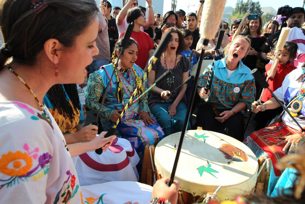
Native American drummers demonstrate at the steps of City Hall during a rally to take strong action on the climate change on February 17, 2013 in Los Angeles, California. David McNewGetty Images
NEW YORK — Not far from the negotiations for a new global development agenda that took place between heads of state at the United Nations General Assembly last month, a small group of female leaders gathered out of the limelight to sign another historic agreement.
The delegation chose not to meet at UN headquarters in east Midtown but on a traditional Native American tribal territory in Central Park’s East Meadow.
Seven women representing eight different tribes signed a treaty to unite the indigenous women of the Americas in friendship to protect the land and people from the harms of climate change and environmental degradation.
In what organizers said was the first-ever indigenous women’s treaty, the women pledged to support the rights of indigenous peoples, commit nonviolent acts of civil disobedience to protect the planet, and demand immediate changes to laws that have led to environmental destruction.
“We’re saying this is the line. We’re done. The destruction stops now,” said Pennie Opal Plant, one of the treaty’s lead signers.
The United Nations recognizes that women are more vulnerable to the effects of climate change because they constitute a majority of the world’s poor and are more dependent on natural resources for their livelihood.
“Women’s role as central stakeholders is one of the most important, yet untold stories of climate change. If we are to have a fighting chance at restoring the health of the Earth and our communities, women’s experiences and knowledge must be brought to the forefront,” said Osprey Orielle Lake, the executive director of Women’s Earth and Climate Action Network (WECAN), at an event where the treaty was later presented.
The signed treaty contends that the laws of Mother Earth “have been violated to such an extreme degree that the sacred system of life is now threatened and does not have the capacity for life to continue safely in the way in which it has existed.”
Opal Plant, who is of the Yaqui, Choctaw and Cherokee tribes, was instrumental in shaping the treaty. She grew up in the shadow of Chevron and Shell refineries in the eastern part of the San Francisco Bay Area, where she saw environmental degradation first-hand. She has organized nonviolent prayer walks in her home city led by Native American elders, but after connecting with other women during a gathering of nature rights advocates in Ecuador 2014, Opal Plant saw opportunity to launch a worldwide movement. She joined several other indigenous leaders from the US and Ecuador — Casey Camp-Horinek of the Ponca tribe, Patricia Gualinga Montalvo and Blanca Chancoso of the Kichwa, and Gloria Hilda Ushigua Santi of the Sápara.
“When women unite and commit to something, shifts happen,” said Montalvo, speaking through an interpreter. “I feel strongly that it’s a time to be heard and for actions to take place.”
Montalvo played a large role in successfully fighting the Ecuadorian government in 2012 in a landmark Inter-American Court of Human Rights case, Sarayaku v. Ecuador, in which the Ecuadorian government was found guilty of rights violations after authorizing oil exploration on Sarayaku lands without prior consultation with the indigenous community.
Opal Plant and her treaty co-signers presented their document at an event hosted by WECAN on Sept. 29, a Global Women’s Climate Justice Day of Action.
Women are disproportionately impacted by climate change, and they are central to solutions, said Orielle Lake at the event.
In the coming months, Opal Plant and her co-signers will create a website to expand the treaty beyond the Americas and allow other groups to sign online. In December, they plan to bring the treaty to COP21, the Paris Climate Conference, and hold another ceremony where more indigenous women leaders will join.
Montalvo’s indigenous community in Sarayaku is constructing a canoe that will travel from Ecuador to France. “The canoe is a symbol of Sarayaku, a symbol of our living forest,” said Montalvo. “We will bring it all the way to Paris so it can navigate the River Seine and so we will be heard.”
In New York, WECAN also presented a Women’s Climate Declaration, which includes a demand to bring back atmospheric carbon dioxide concentrations to below 350 parts per million — which many scientists agree is a level that avoids catastrophic global warming — and an aim to ensure that women’s groups have access to funding to adapt to climate change that is already happening. The declaration already has garnered over 2 million signatures and will be delivered at COP21 later this year.
Women comprise 20 million of the 26 million people estimated to have been displaced by climate change, according to a 2010 report by the Women’s Environmental Network.
“I ask that as temperature rises, that we rise,” said Orielle Lake.
A new study shows that stormwater runoff from urban roadways is so toxic to coho salmon that it can kill adult fish in as little as 2½ hours.
But the research by Seattle scientists also points to a relatively easy fix: Filtration through a simple, soil-based system.
“It’s basically … letting the Earth do what it does so well, what it has done for eons: cleaning things up,” said Julann Spromberg, a toxicologist for the National Oceanic and Atmospheric Administration and co-author of the report published Thursday in the Journal of Applied Ecology.
Scientists have long suspected that the mixture of oil, heavy metals and grime that washes off highways and roads can be poisonous to coho, but the study is the first to prove it.
The research got its start more than a decade ago, when habitat-restoration projects began coaxing a trickle of coho back to several urban streams in the Puget Sound area. But many of those fish died before they could spawn. And the deaths seemed to coincide with rainstorms that sent runoff surging through drainage pipes and into the waterways.
In some place, like Longfellow Creek in West Seattle’s Delridge area, up to 90 percent of females were killed.
“It was apparent that something coming out of those pipes was causing it,” Spromberg said.
She and her colleagues tried to reproduce the effect in the lab. But the artificial mixture of oil and other chemicals they concocted had no effect on the fish.
So their next step was to try the real thing: Actual runoff, collected at NOAA’s Northwest Fisheries Science Centerfrom a downspout that drains a Highway 520 onramp near Montlake.
“When we brought out the real urban runoff: Bang! They were down, they were sick, they were dead,” said co-author Jenifer McIntyre, a researcher at Washington State University’s Puyallup Research and Extension Center.
In experiments at the Suquamish tribal hatchery near Poulsbo, every coho exposed to the runoff died — some within a few hours, all within a day. Before death, the fish became lethargic, rolled around and swam to the surface as if gulping for air, McIntrye said.
The fact that actual runoff proved fatal while the scientists’ concoction did not underscores an unsolved mystery about which chemical or combination of chemicals are so toxic to the fish. It could be any number of compounds that weren’t part of the artificial brew, including byproducts of oil and gasoline combustion, chemicals released by tires or tiny particles from brake linings, Spromberg said.
“We still need to keep looking at what exact compounds are involved.”
But whatever the chemical culprit, the scientists found it could be removed by passing the runoff through 55-gallon drums packed with layers of gravel, soil and compost. None of the fish exposed to the filtered stormwater died or fell ill.
“It was remarkable,” McIntyre said.
The finding is a strong endorsement of rain gardens, grassy swales and other “green” alternatives to traditional drains and pipes designed to collect stormwater. The idea is instead to let the runoff percolate through the ground, as it did before so much of the area was paved and developed.
State regulations strongly encourage developments to use such approaches, according to the Washington Department of Ecology. A project called 12,000 Rain Gardens in Puget Sound is also promoting their use.
“We should be seeing more and more of these systems in the future,” McIntyre said.
Coho, which were once abundant throughout the Northwest, may be particularly vulnerable to toxic runoff because they spawn in the fall, prompted by seasonal rains. Habitat destruction, fishing and other factors almost certainly contributed to the species’ precipitous decline, Spromberg said.
Chum salmon, whose habitat and spawning seasons overlap those of coho in many places, don’t appear to be as affected by runoff — something the scientists plan to investigate this fall.
Perhaps the major limitation of the study is the small sample size. Only 60 coho were used in the experiments, 20 in each of two experimental and one control groups. The scientists were lucky to get that many, thanks to the cooperation of the Suquamish Tribe, McIntryre said.
Also, the urban runoff collected near Montlake was undiluted in the experiments and represents about the worst possible case: runoff from a busy highway in a big city, a DOE official who was not involved in the study pointed out.
“It’s great that the treatment gets rid of toxicity from this nasty stuff,” Karen Dinicola of DOE’s stormwater program wrote in an email. But it’s particularly challenging to retrofit urban-collection systems with greener alternatives, she said.
But the results of the research could help guide future development in rural watersheds where coho runs remain, the researchers said. And it can also be used to help inform urban-restoration projects as well, so fish aren’t lured back to appealing habitats, only to be clobbered by toxic runoff.
The researchers are preparing for their next round of studies, which will include tests to zero in on what is actually killing the coho.
The rain that soaked the region Wednesday also filled their runoff-collection barrels, Spromberg said.
“We only have one shot a year, when the fish come back and we can do the experiments and take the samples,” she said. “Hopefully, with this rain we’ll have more fish coming in soon.”
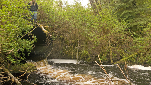
The Squaxin Island Tribe is working with the South Puget Sound Salmon Enhancement Group to restore vital forage fish habitat by removing a 70-foot-long boat basin and a 137-foot-long boat ramp to reconnect a large drift cell along the shoreline.
“This kind of habitat, that forage fish use to spawn in, is critically important for deep South Sound,” said Scott Steltzner, salmon biologist for the Squaxin Island Tribe. A drift cell is a portion of shoreline that has a common source of sediment. When the habitat within these cells is disconnected, the actual amount of habitat available to forage fish can shrink.
The boat basin takes the form of a perpendicular cut into the beach near the mouth of Hammersly Inlet. Ten foot high walls were designed to protect a resident’s boat from the surf and tide and the boat ramp provided access to Puget Sound, but they also cause a lot of problems for what salmon like to eat.
After removing the concrete boat basin and ramp, the Tribe will restore the original slope of the beach, recovering the spawning habitat lost to forage fish This will allow sediment to naturally move supplying sediment to beach spawning forage fish and those off shore.
Forage fish, such as herring, sandlance, and surfsmelt, are important food for juvenile and adult salmon. Where they spawn marks critical habitat for salmon. “Forage fish spawn in the same places as juvenile salmon feed,” said Scott Steltzner, salmon biologist for the Squaxin Island Tribe. “Restoring this habitat will mean more food for salmon, which will help recovery depressed stocks.”
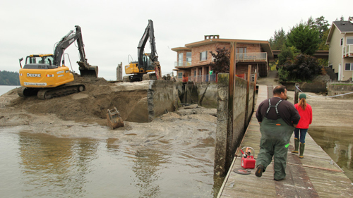
A few years ago, the tribe completed another fish friendly project when they replaced an aging, outdated boat ramp with a new ramp that would allow sediment to more naturally move. “This boat ramp is not only important to tribal fishers, but for shellfish companies and the general public,” said Andy Whitener, natural resources director for the tribe. “When we set out to replace it, it seemed fitting we’d do it in a fish friendly manner.”
In addition to providing more room for forage fish, nearshore habitat also provides important rearing areas for juvenile salmon before they move out to the open ocean. Nearshore habitat is a productive swath of land close in to the coast that serves an important role in the life-cycle of salmon.
With the Tulalip Tribes doing the last bits of finishing work, the city of Marysville is now looking at its next big project: building 1.8 miles of new trail around the new estuary.
The city is planning a 12-foot wide paved trail that would lead from Ebey Waterfront Park down to the estuary. Another segment will run on the east side of the breached levee up to Harborview Park in the Sunnyside neighborhood.
If all goes according to plan, the two segments of trail would be complete by the end of 2016.
It’s a big deal for the city, which has relatively little in the way of publicly available waterfront.
“We’ve only had about 900 feet of access to our shoreline and this will change that significantly,” said Jim Ballew, Marysville’s director of Parks and Recreation.
The project is estimated to cost between $1 million and $1.2 million, $500,000 of which was in the most recent budget from the Legislature.
That also meant that the city’s trail project was delayed due to the extended budget debates in Olympia this year. The original plan was to have the western segment of the trail done by the end of the year.
“We had to wait for the Legislature to approve the funding, and that was so delayed this year that we don’t even have a contract yet,” Ballew said.
“We’ve got it within our capital budget; it’s ready to go,” Ballew said.
The new plan calls for finishing the design work by the end of the year and expanding the project to include not just the trail, but other waterfront improvements and interpretive signs along the route.
Further out, the plans will include the eventual construction of a mile-long loop around the estuary connecting the trail’s west and east legs.
Funding so far only exists for the initial segments, meaning there will be a gap in the trail until some time in the future.
The Qwuloolt Estuary restoration project is intended to create better habitat in the Snohomish River watershed for migratory salmon, especially juveniles that need a place to mature for up to a year or two while they gradually get used to a marine environment.
The Tulalip Tribes have spent $20 million over 20 years on the estuary, with the final levee breach taking place Aug. 28.
All that’s left now is to seal off the former tide gates and dig a final stormwater pond, said Josh Meidav, a restoration ecologist with the Tulalip Tribes.
So far, Meidav said, the results of the levee breach have met their expectations.
“The channel itself at low tide or incoming tide is actually capturing a good amount of the Ebey Slough inflow,” he said.
Some marine fish have been seen in the upper reaches of the estuary and the reed canary grass is starting to die off, Meidav said.
The city plans to reach out to the scientific community, the tribes and even the birdwatching community to provide input into the interpretive elements of the trail.
“We’ll be spending a lot of time with those specialists,” Ballew said.
A lack of water has left apple trees in Benton County dry and brittle as severe drought conditions persist across 68 percent of Washington State. Courtesy of Washington Department of Ecology
Don’t be fooled by the recent rain and cooler temperatures. Most of Oregon and Washington are still experiencing severe or extreme drought.
With many of the region’s reservoirs and streams still far below normal and a warm winter on tap, experts are predicting this year’s drought will likely continue into next year.
On a conference call Thursday, Washington Department of Ecology Director Maia Bellon said her agency is preparing for the worst: another year of drought that will take hold earlier and take an even bigger toll on the state.
“This historic drought is not over, and we’re already planning for next year,” Bellon said. “We face winter with a huge water deficit. Rains are desperately needed to recharge these reservoirs and even that won’t be enough to get us through next summer. We need winter snowpack – what we call our frozen reservoir – and there’s growing concern we may not get it.”
Projections for this year’s winter temperature and precipitation relative to normal conditions from 1981-2010.
Courtesy of Washington Department of Ecology
Washington State Climatologist Nick Bond said there’s a 10- to 15-percent chance this winter will be just as warm and devoid of snow as last winter.
“There’s been recently some rain and cooler temperatures, but are we out of the woods?” he said. “The answer, I’m afraid, is no. El Nino is rearing its ugly head in the tropical Pacific. It’s of the magnitude and type that is strongly associated with warmer than normal winters around here, and warmer ocean temperatures off our coat, the blob, will be a contributing factor. All in all, the odds are strongly tilted towards another toasty winter.”
Oregon’s outlook is much the same, according to Kathie Dello, associate director of the Oregon Climate Research Institute.
“Nothing is pointing to us having a great winter,” she said. “The warmer-than-normal temperature prediction is the most disconcerting.”
With so many low reservoirs and rivers, Dello said, even slightly below-average precipitation this winter would leave the region with a water deficit going into next year.
Indigenous struggles against resource extraction are gathering strength in the Pacific Northwest
Under the breaking waves of Lummi Bay in northwest Washington, salmon, clams, geoducks and oysters are washed in rhythmic cascades from the Pacific Ocean. Just north of here is Cherry Point, home for three intimately related threatened and endangered species: herring, Chinook salmon, and orcas. It is also the home of the Lummi Nation, who call themselves the Lhaq’temish (LOCK-tuh-mish), or the People of the Sea. The Lummi have gone to incredible lengths to protect the health of this marine life, and to uphold the fishing traditions that make their livelihood inseparable from the life of the sea — continuing a bond that has connected them to the salmon for more than 175 generations.
Photo by Nicholas Quinlan/Photographers for Social ChangeThe Lummi Nation is currently fighting a proposal to build the largest coal export terminal on the continent at Cherry Point.
The Lummi Nation is currently fighting the largest proposed coal export terminal on the continent (read “Feeding the Tiger,” EIJ Winter 2013). If completed, the Gateway Pacific Terminal would move up to 54 million tons of coal from Cherry Point to Asian markets every year. The transport company BNSF Railway plans to enable the terminal by adding adjacent rail infrastructure, installing a second track along the six-mile Custer Spur to make room for coal trains.
The project is one of many coal export facilities proposed across the US by the coal extraction and transportation industry. In the face of falling domestic demand for the highly polluting fossil fuel, the industry is pinning its survival on exporting coal to power hungry Asia, especially China.
The Gateway proposal has sparked massive opposition from the Lummi, who say it will interfere with their fishing fleet, harm marine life, and trample on an ancient village site that has been occupied by the Lummi for 3,500 years. The village, Xwe’chieXen (pronounced Coo-chee-ah-chin) is the resting place of Lummi ancestors, and contains numerous sacred sites that the Lummi assert a sacred obligation to protect. The Lummi’s connection to their first foods, and to the village site that holds their ancestors’ remains, goes the very heart of who they are as a people, and the Nation has pledged to protect both “by any means necessary”.
The Lummi are no strangers to stopping harmful development. In the mid-1990s they managed to stop a fish farm in the bay; in 1967 they fought back a magnesium-oxide plant on Lummi Bay that would have turned the bay lifeless with industrial waste.
The new threat to the Lummi Nation is being proposed by the global shipping giant SSA Marine. The coal would be supplied by Peabody Energy and Cloud Peak Energy — companies that mine in Montana and Wyoming’s Powder River Basin. It was also backed by Goldman Sachs until January 2014, when the company pulled its substantial investment from the project.
Jay Julius, a fisherman and Lummi Nation council member had attended the firm’s annual shareholders meeting back in 2013 and urged it to “take a look at the risk” of their investment.
Another coal export proposal of similar scale has been proposed in Longview, Washington about 235 miles south from Cherry Point. This has been opposed by the Cowlitz Tribe, who object to the impacts that coal would bring to the air and water quality along the Columbia River. This terminal would also create serious harm to another Native tribe at the point of extraction, 1,200 miles away in the Powder River Basin.
The Millennium Bulk Terminal in Longview is a joint proposal from the Australia-based Ambre Energy and Arch Coal, the US’ second largest coal producer after Peabody.
The terminal, which would export up to 48.5 million tons of coal annually, would be supported by Arch Coal’s proposed Otter Creek Mine in southeastern Montana (bordering Wyoming). If built, the mine could produce an estimated 1.3 billion tons of coal, and would span 7,639 acres along the eastern border of the Northern Cheyenne Indian Reservation. This would be the largest mine ever in the United States.
Photo by Mike Danneman Coal trains operated by BNSF would haul coal from the Powder River Basin in Wyoming and Montana to a series of proposed export terminals along the Pacific Northwest coast.
To connect the proposed mine to West Coast ports, Arch Coal and BNSF Railway want to build a new 42-mile railroad — called the Tongue River Railroad — through the Northern Cheyenne Indian Reservation. Members of the Northern Cheyenne Nation and their allies have pledged fierce resistance if regulators approve the mine and the railroad, which they say, would have significant impacts on public health and the environment. According to BNSF, anywhere from 500 pounds to 1 ton of coal can escape from a single loaded rail car – on trains pulling 125 cars.
At a June hearing on the railroad organized by the US Surface Transportation Board, federal regulators heard nothing but fierce opposition to the proposed mine and its enabling railroad. A significant proportion of the Lame Deer community from the Northern Cheyenne Reservation turned out to the hearing. Their opposition to the project was echoed by local ranchers.
One rancher told the officials that they needed to understand the importance of history when they propose such unprecedented projects. “Northern Cheyenne history is very sad – it’s tragic – and they have fought with blood to be where they are tonight.”
“My ancestors have only been buried here for about four or five generations,” he said, but “we know of lithic scatters, we know of buffalo jumps, we know of stone circles, camp sites, vision quest sites… and it is my obligation as a land owner, even though I am not a member of this Nation, that we protect what is there.”
One tribal member, Sonny Braided Hair, was more explicit in his history lesson. “Let us heal,” he said, “or we’ll show you the true meaning of staking ourselves to this land.” He was referring to the Cheyenne warrior society known as the Dog Soldiers, who became legendary in the mid-1800s for holding their ground in battle by staking themselves to the earth with a rope tied at the waist.
Such concerns about sacred sites are too often validated. In July of 2011, before applying for any permits, SSA Marine began construction at a designated archeological site in the ancient Lummi village at Cherry Point, where the Lummi have warned of numerous sacred sites, and where 3,000 year-old human remains have been found.
Pacific International Terminals had earlier promised the Army Corps of Engineers that this site would not be disturbed, and that the Lummi Nation would be consulted before any construction began nearby. They also acknowledged their legal obligation to have an archaeologist on staff when working within 200 feet of the site, along with a pre-made “inadvertent discovery” plan if any protected items were disturbed. Despite all of these assurances, the company illegally sent in survey crews to make way for their terminal, where they drilled about 70 boreholes, built 4 miles of roads, cleared 9 acres of forest, and drained about 3 acres of wetlands.
In August, Whatcom County, Washington, (where Cherry Point is located) issued a Notice of Violation to Pacific International Terminals, and the Department of Natural Resources documented numerous violations of the state Forest Practices Act. The total fines and penalties, however, added up to only about $5,000.
That’s a small price to pay for early geotechnical information, says Philip S. Lanterman, a leading expert on construction management for such projects. According to Lanterman, the information provided by those illegal boreholes was probably a huge economic benefit to the planned project. Needless to say, the meager fines don’t come close to discouraging the behavior. For opponents this incident is just a taste of things to come, and one resounding reason to never trust King Coal.
In the face of such blatant violations of their treaty rights, several Native tribes in North America — from the Powder River Basin, through the Columbia River to the Salish Sea —have banded together and declared that it is their sacred duty to protect their ancestral territories, sacred sites, and natural resources.
In May 2013, the Affiliated Tribes of Northwest Indians (ATNI) unanimously adopted a resolutionopposing fossil fuel extraction and export projects in the Pacific Northwest. In the resolution, the 57 ATNI Tribes of Oregon, Idaho, Washington, southeast Alaska, Northern California, Nevada and Western Montana voiced, “unified opposition” to investors and transporters and exporters of fossil fuel energy, “who are proposing projects in the ancestral territories of ATNI Tribes.” The resolution specifically calls for protection of the Lummi Nation’s treaty-protected fishing rights, and the sacred places that would be affected by the Cherry Point project.
Indigenous resistance to these projects has been bolstered by allies in the environmental movement who have been fighting the export of US coal to foreign markets in the East. Of 15 recent proposals to build major new coal export facilities across the US, all but four (including Gateway and Millennium) have been defeated or canceled within the past two years.
In January this year, the Lummi Nation asked the Army Corps to immediately abandon the environmental review for Gateway Pacific and the Custer Spur rail expansion, stating that the project violates their reserved and treaty-protected fishing rights. If the environmental review is abandoned, the Army Corps would have effectively cancelled the project. In response to this letter the Army Corps gave SSA Marine until May 10 to respond, but later extended the deadline by another 90 days. Environmental reviews of the terminal and BNSF’s Custer Spur rail expansion are due in mid-2016, but it appears likely that the Army Corps will have rejected the Gateway Pacific terminal by then, rendering any rail expansion redundant.
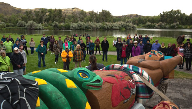
Photo courtesy of Sierra ClubIn 2013, James launched a totem pole journey to build solidarity for Indigenous-led struggles against fossil fuels, including the struggle to protect Xwe’chieXen. Pictured here, ranchers, environmentalists, and members of the Northern Cheyenne totem pole blessing ceremony in Billings, Montana.
In order to keep the pressure on, leaders from nine Native American tribes gathered in Seattle on May 14 to urge the Army Corps to deny permits for SSA Marine. “The Lummi Nation is proud to stand with other tribes who are drawing a line in the sand to say no to development that interferes with our treaty rights and desecrates sacred sites,” said Tim Ballew II, Chair of the Lummi Indian Business Council. “The Corps has a responsibility to deny the permit request and uphold our treaty.”
The Lummi have clearly had important successes in stopping harmful development in the past. But with so much on the line for coal companies, can they really use treaty rights to stop a coal terminal of this size? “Without question,” says Gabe S. Galanda, a practicing attorney specializing in tribal law in Washington State. “Indian Treaties are the supreme law of the land under the United States Constitution, and Lummi’s Treaty-guaranteed rights to fish are paramount at Cherry Point.” If the Army Corps decides to deny their permit, Galanda says that coal developers would find it “very difficult if not impossible” to successfully challenge them. By contrast, he says, “the Lummi Nation would have very strong grounds to attack and invalidate” any approval that the Army Corps might grant to the coal exporters.
In a similar case last year, Oregon’s Department of State Lands denied a key building permit for Ambre Energy’s coal export terminal project in Boardman, Oregon. The terminal was planned directly on top of a traditional fishing site of the Yakama Nation. In both Boardman and Cherry Point, the coal companies have implied that the protected Indigenous sites that would be harmed by their projects either do not exist, or that the tribes using them are too incompetent to know their true location.
Just two years after filing paperwork with Whatcom County admitting that they had “disturbed items of Native American archeological significance”, Bob Watters of SSA marine wrote “Claims that our project will disturb sacred burial sites are absolutely incorrect and fabricated by project opponents.”
One of the Cherry Point Terminal’s most fierce opponents is the diplomat, land defender and master carver Jewell Praying Wolf James. James is the head of the Lummi House of Tears Carvers, and has created a tradition out of carving and delivering totem poles to places that are in need of hope and healing.
In 2013, James launched a totem pole journey to build solidarity for Indigenous-led struggles against fossil fuels, including the struggle to protect Xwe’chieXen. James traveled 1,200 miles with his totem pole in 2013 — from the Powder River Basin to the Tsleil Waututh Nation across the Canadian border. In 2014, he launched another 6,000-mile totem pole journey in honor of revered tribal leader Billy Frank Jr, a Nisqually tribal member and hero of the fishing rights struggle. Frank passed away on May 5, 2014 — the same day he published his final piece condemning coal and oil trains.
These totem pole journeys have gained international attention as pilgrimages of hope, healing, decolonization, and Native resistance to the extractive industries.
At the end of August, James concluded his third regional totem pole journey against fossil fuels, carrying the banner of resistance to many tribes who are standing up as fossil fuel projects get knocked down. He held blessing ceremonies in Boardman and Portland where coal and propane projects were recently shot down, passed through the Lummi Nation and Longview where coal has yet to be defeated, and ended in the Northern Cheyenne Nation at Lame Deer, where the community has rallied in opposition to a mine whose devastation would reverberate from Montana, down the Columbia River, and up to Cherry Point.
“There are many of us who are joining, from the Lakota all the way to the West Coast, to the Lummi, south to the Apache, up to the Canadian tribes,” said Northern Cheyenne organizer Vanessa Braided Hair at a recent Tongue River Railroad hearing. “We’re gonna fight, and we’re not gonna stop.”
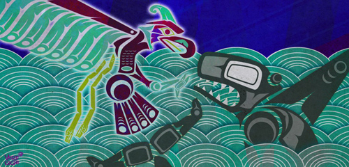
Thunderbird and Whale had a terrible fight. Illustration by Jeffrey Veregge
Mega-quakes have periodically rocked North America’s Pacific Northwest. Indigenous people told terrifying stories about the devastation but refused to leave.
In the year 1700, on January 26, at 9:00 at night, in what is now northern California, Earthquake was running up and down the coast. His feet were heavy and when he ran he shook the ground so much it sank down and the ocean poured in. “The earth would quake and quake again and quake again,” said the Yurok people. “And the water was flowing all over.” The people went to the top of a hill, wearing headbands of woodpecker feathers, so they could dance a jumping dance that would keep the earthquake away and return them to their normal lives. But then they looked down and saw the water covering their village and the whole coast; they knew they could never make the world right again.
That same night, farther up the coast in what is now Washington, Thunderbird and Whale had a terrible fight, making the mountains shake and uprooting the trees, said the Quileute and the Hoh people; they said the ocean rose up and covered the whole land. Farther north still, on Vancouver Island, dwarfs who lived in a mountain invited a person to dance around their drum; the person accidentally kicked the drum and got earthquake-foot, said the Nuu-chah-nulth people, and after that every step he took caused an earthquake. The land shook and the ocean flooded in, said the Huu-ay-aht people who are part of the Nuu-chah-nulth, and people didn’t even have time to wake up and get into their canoes, and “everything then drifted away, everything was lost and gone.”
Here’s what geologists say: the earthquake that almost certainly occurred on the night of January 26, 1700, ruptured North America’s Pacific Northwest coast for hundreds of kilometers, from northern California, through Oregon and Washington, to southern Vancouver Island. Along this coast, the Juan de Fuca plate was pushing under the larger North American plate, had gotten stuck—locked—but kept pushing until it released, abruptly and violently. The earthquake that resulted was probably a magnitude 9, about as big as earthquakes get. The coast dropped by as much as two meters, and a tsunami brought floods more than 300 meters inland.
Geologists now know that the Pacific Northwest has been having these earthquakes and tsunamis irregularly every 500 years or so; their oldest record in sediments goes back at least 10,000 years. The evidence is massive: subsided marshes, drowned forests, sediment layers showing enormous landslides that flowed out on the ocean floor, seismic profiles of the Juan de Fuca plate, and satellite measurements of a coast deforming from the stress of a plate that’s once again locked. In the next 50 years, the chance of another magnitude 9 earthquake there is 1 in 10.
On Vancouver Island, the Nuu-chah-nulth people told tales of mountain dwarves inviting a person to dance around their drum. When the person accidentally kicked the drum—depicted in the illustration above by Nuu-chah-nulth artist Tim Paul—he got earthquake foot and his steps set off vast tremors. Image courtesy of the Royal BC Museum and Archives
In the cities of the Pacific Northwest, the impact will be terrible. Many buildings were built before architects knew the area had earthquakes; later buildings were built with short, sharp California earthquakes in mind, not the Northwest’s longer, larger ones. “The ground’s going to shake for three minutes,” says Thomas Heaton, geophysicist at the California Institute of Technology and one of the first to propose the area’s earthquake potential. “And [in simulations] it’s easy to come up with ground motion that would collapse tall buildings.” Then comes the tsunami, and “with magnitude 9 earthquakes,” says Heaton, “you always get tsunamis.” Governments of course know this: seismic networks and a tsunami warning system are in place; governments and institutions in the Pacific Northwest have emergency plans, are educating the public in how to respond, and have published evacuation maps; buildings and bridges that fail to meet the modern earthquake building codes are being retrofitted.
But all this—the governments’ plans for the next earthquake and geologists’ understanding of the ancient ones—happened only in the last few decades. For the same 10,000-plus years that the Pacific Northwest has been having the earthquakes, indigenous groups have been living there. They have known forever that what the ground did was sudden and violent, that it came accompanied with catastrophic floods, and that it made people die. The questions for us, living in the present, are obvious. What was it like? And what was the impact of millennia of repeated catastrophes on the indigenous groups of the region? The answers seem obvious too, but they aren’t; this turns out to be a story about stories—how they merge into histories, how fragile they are, and how urgent.
What the indigenous people knew all along, geologists have known only since 1984. Thomas Heaton was still in college in 1970 when geologists, who knew that the world’s largest earthquakes occurred where one tectonic plate descended under another one, first recognized that one of these subduction zones ran between the Juan de Fuca and North American plates. But the so-called Cascadia Subduction Zone had no record of ever producing large earthquakes. So, says Heaton, “they thought it was aseismic, just creeping.”
Then in the early 1980s, the US Nuclear Regulatory Commission (NRC) was considering whether to locate nuclear power plants in Washington and Oregon, and, just to be sure, asked the US Geological Survey (USGS) whether the Cascadia Subduction Zone was safe from earthquakes. Heaton, then at the USGS, knew about subduction zones because he’d consulted for Exxon on oil platforms in earthquake-prone Alaska. He compared the Cascadia zone with known earthquake areas and told the NRC, “Well, maybe it is aseismic, but another interpretation is, it looks like Chile—which is also aseismic, except for the big ones.” Perhaps, Heaton suggested, the Cascadia zone had escaped earthquakes only because it was currently locked.
Heaton published his surmise in 1984, and within a few years, Brian Atwater, also at the USGS, and other geologists found evidence of moving ground and great floods. But building geological evidence into a credible theory can take decades, and in the meantime, a colleague of Atwater’s and Heaton’s named Parke Snavely had been reading stories from the Makah people in Washington that described what sounded like floods. One Makah story in particular resembled the 1700 tsunami. “A long time ago but not at a very remote period,” the story began, the ocean receded quickly, then rose again until it submerged Cape Flattery; canoes were stranded in trees and many people died.
Snavely told Heaton about the stories, and the two of them did something un-geoscientific: they decided to take the Makah story not as myth, but as history. That is, they assumed the Makah were describing a geologically-recent tsunami, compared the Makah narrative with their understanding of Cape Flattery’s geology, found the similarity between story and geology “noteworthy,” and published their findings in the scientific literature. After that, other scientists also went looking in the stories for history. A team of anthropologists, geologists, and indigenous scholars led by geologist Ruth Ludwin of the University of Washington took 40 stories collected from native groups along the entire Cascadia Subduction Zone. They compared the narratives to what was known of the 1700 earthquake and tsunami, and found in effect, that the whole coast had been telling stories about it.
Alan McMillan and Ian Hutchinson—archaeologist and geographer, respectively, from Simon Fraser University in British Columbia—found other stories, most of them undateable, that were probably about other, even earlier earthquakes. The two scientists systematically plotted these coastal stories on a map of the archaeological and geological evidence of all Cascadian earthquakes and tsunamis. Along the coast—from the Yurok and Tolowa in northern California, the Tillamook in Oregon, the Quileute in Washington, to the Nuu-chah-nulth on Vancouver Island—were stories of Earthquake, Thunderbird, and Whale, or the mountain dwarfs and their earthquake drum. The Cowichan people on Vancouver Island, the Squamish in southern British Columbia, and the Makah in Washington each had stories about the earth shaking so violently that no one could stand, or the houses falling apart, or rockslides coming out of the mountains and burying villages. The Nuu-chah-nulth, like the Makah, told stories of the ocean receding suddenly, then flooding back powerfully and killing many, many people.
From the Tolowa people in northern California: one autumn, the earth shook and the water began rising. People began running and when the water reached them, they turned into snakes. But a girl and a boy from the village, both adolescents, outran the water by running to the top of a mountain where they built a fire to keep themselves warm. After 10 days, they went back down and the houses they lived in were gone, all that was left was sand, and all the people and animals were lying on the ground dead. The boy found food for the girl and then set out to look for people and a place to live. But the only people he found were dead ones. The boy came back and said he could find no one else for either of them to marry, so they’d better marry each other. They built a house and after a time, had babies. And many years and many generations later, there were many people who were “scattered everywhere and in every place there was a man living with his wife.”
Many scientific papers say that the indigenous stories are reasonable records, covering an unknowable amount of time, of earthquakes and tsunamis along the entire Cascadia Subduction Zone. They also add that so much destruction repeated for so long must have had a terrific impact on the indigenous groups’ worlds—that given their history, the indigenous people of the Pacific Northwest would have taken catastrophe to heart. You might expect that they’d arranged their culture and lives around disaster. And further, you might hope that the impact on them would have some message, some advice, for us in the 21st century, waiting for our own disaster. But here’s where this storyline goes cold. Any such impact ought to show up in archaeological and anthropological evidence and it just doesn’t.
The people must have lost their houses and villages and livelihoods, they must have been ruined; but afterward they went back to living in the ruined places. McMillan went looking in the archaeological record for evidence of habitation and abandonment over the past 3,000 years in 30 excavated villages along the Washington and Vancouver Island coasts. “The seismic events were catastrophic but short term,” McMillan says. “The evidence is all that the sites were reoccupied afterward.”
Illustration by Mark Garrison
Nor did the people ultimately change the ways they lived. Robert Losey, an anthropologist at the University of Alberta in Edmonton, looked for evidence that after the 1700 earthquake the Tillamook people of Oregon changed what they hunted, what they ate, how their houses were built, and where they lived. “In the short term, the earthquake must have been horribly traumatic,” Losey says. But in the long term, “I don’t think it made a difference.”
Anthropologists and archaeologists seem to agree that not only was it normal to return to the life you already know how to live, but, as Losey says, it was also reasonable. The catastrophes came generations apart. The food that was gathered and hunted apparently rebounded quickly. And the architecture designed for seasonal mobility was generally single-story, made of flexible wood tied with cord, and might as well have been built to modern earthquake codes. “The First Nations did an entirely human thing,” Losey says. “They went right back and settled in harm’s way.” The Pacific Northwest turns out to be, in the long run, a place conducive to resilience.
So the clearest evidence of the impact of earthquakes and tsunamis on the coast’s indigenous people has to be in the stories. Maybe the stories explain how to be resilient, how to outsmart disaster. Maybe they warn the children to warn their own children. The 2004 Indian Ocean earthquake that killed 200,000 people in the Indonesian province of Aceh, killed only seven of the 78,000 people living on the island of Simeulue because the Simeulueans had been telling stories for generations of what to do during tsunamis. That may well have been the case in the Pacific Northwest, but the fact is, nobody knows for sure.
The reason is, the indigenous people of the Pacific Northwest didn’t write down their earthquake stories; the stories were told only face to face. And apparently they’re not told much, if at all, any more.
The only stories that we know for certain still exist are the ones collected and written down by ethnographers—the Yurok stories by A. L Kroeber, for instance, or the Makah stories by Judge James Swan—a century and more ago. Deborah Carver, an independent scholar, followed up the collected Yurok stories by tracking down the descendants of one storyteller and asking if they had heard the stories. “Nobody in the present had,” she says, except for one guy and his grandmother.
David Lewis, an anthropologist, independent scholar, and a member of the Grand Ronde tribe, never heard the old stories growing up, “only in my adult life,” he says, “since I’ve been working for the tribe.” And when someone did tell the stories, it was only “because I asked.” So the existing stories have the same caveats that archeological artifacts do: they’re incomplete, depend on what happened to be collected, and may not accurately represent the folklore at all.
The stories are incomplete in another, more fundamental, way: stories not written but told depend on having a culture that keeps telling them. In the late 1700s, Europeans began turning up regularly in the Pacific Northwest, bringing with them waves of epidemics, most notably smallpox. Since no one knew how many indigenous people lived there then, no one knows for sure how many died, but the estimates are shocking: they range from 30 to 95 percent.
Later Europeans continued what disease began. They wanted the coastal land, the fur of its animals, and the gold underneath it, and thus began the long indigenous history of resettlement onto reservations, re-education in government- and church-run boarding schools, and outright slaughter in warfare. Whatever the motives or intents of European explorers, government agents, fur traders, gold miners, and educators, their result was cultural scorched earth. Jason Younker is an anthropologist at the University of Oregon and a member of the Coquille tribe: growing up, he explains, “my father said to forget what I knew about being Coquille because it will do you no good.”
Kill the culture and the stories die. “If you think about the history of First Nations in the last couple hundred years,” says Losey, “huge amounts of the population were lost even before ethnographers could get to them. We have no idea how many stories existed—ethnographers published a few thousand—but certainly [there were] far more than were written down.” Ruth Ludwin, the geologist at the University of Washington who collected earthquake and tsunami stories, wrote that 95 percent of the stories were lost.
But even in the few stories that are left, earthquakes and tsunamis are still so vivid that the complete range of stories must have been full of them. “There was a great storm and hail and flashes of lightning in the darkened, blackened sky, and a great and crashing ‘thunder-noise’ everywhere,” said the Hoh people of Washington. “There were also a shaking, jumping up and trembling of the earth beneath, and a rolling up of the great waters.”
Younker himself had heard at least one of the stories. He was about to leave home to begin a decade of graduate work in anthropology when his uncle took him to Sundown Mountain along the Oregon coast, and up to a high plateau, where they watched the fog coming off the ocean and moving up through a river valley. “You see, Jason, how the fog is coming in?” the uncle said, and told him a story. Not all that long ago, a great tide came in the same way, the water rushed up the valleys, drowned the villages, and covered the trees. Some people climbed into their canoes, along with long ropes they’d prepared, tied themselves to the tops of the trees, and rode out the flood. The people who hadn’t prepared long ropes were swept away and were never seen again. Younker thinks his uncle told him that story partly so that Younker could tell even younger people how to prepare, and partly to say, “make sure you keep your ropes long and your connections to home are well-maintained so you can pull yourself back to home. Because you really can’t separate the past from the present.”
Robert Dennis, Chief Councillor of the Huu-ay-aht First Nation in British Columbia, had also heard stories. When he was 11 or 12 years old, he used to visit his great-grandfather, who’d been chief of the Huu-ay-aht for decades. “He’d say, ‘I’m going to tell you things that might be important in your life, and this could happen again.’” One of his stories was about his great-grandfather who lived at Pachena Bay, on the west coast of Vancouver Island. One night the land shook, and a big wave smashed into the beach, and the people who lived on the bay were all killed. But the people who lived on high ground, the water couldn’t reach them, and they came out of the tsunami alive. Dennis thought his great-grandfather told him this story so Dennis could someday tell the story himself and because he also would be a leader responsible for his people. So years later when the Huu-ay-aht were planning a community center, they first consulted their elders, then they built the center not down in the flats but up on high ground. Now they have to stock it with food and emergency gear and keep it stocked. “I’m not going to rest,” says Dennis. “I’m going to keep pushing it. So we’re ready.”
The ground moves and doesn’t stop moving, and almost no one survives the tsunami. So get off the beach. Go up into the hills. Build on high ground. Tie your boats with long ropes. Make sure your children know, as Robert Dennis’s great-grandfather said, that this is “what this land does at times.” And don’t bother trying to separate the present from the past.
Smaller than average coho and pink salmon are returning to local rivers, and the warm water blob off the coast could be to blame.
The runs are smaller in both number and weight. The average coho size in the recent catch of a Squaxin Island tribal fisherman was just 3.4 pounds, less than half of the 8-pound average weight of a coho.
Lorraine Loomis, NWIFC chair and Swinomish fisheries manager, observed the trend in smaller pink salmon in a recent fishery.
“Where they’re usually four and a half, five pounds, they’re about three, three and a half pounds now,” she said. “So they’re quite small.”
Dower and other researchers have been concerned what might be happening to the important food source as the water off the B.C. coast has warmed over the past year and a half.
“We were quite keen to get out here and see what was going on,” he said.
“One way to think about plankton is you’ve got your crunchies and you’ve got your squishies.”
The species that usually dominate in colder water tend to be “crunchies,” he said: krill and other shrimp-like animals that are high in nutritious fatty acids and oils.
“What we’re seeing is a lot of [squishies], gelatinous types of zooplankton, and they’re not nearly as nutritious as the normal species of plankton that we find off the coast here.”