“Is this the world that we want to leave to our children?”

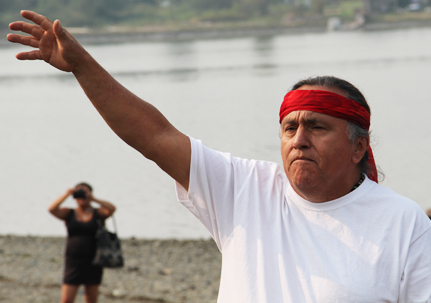
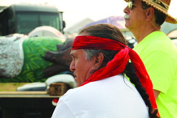
James Jewell, Master Carver of the Lummi Nation’s House of Tears Carvers.Photo/Niki Cleary, Tulalip News
James Jewell, Master Carver of the Lummi Nation’s House of Tears Carvers.
Photo/Niki Cleary, Tulalip News


by Kim Kalliber, Tulalip News


“Is this the world that we want to leave to our children?”

That is the question posed by Jewell James, Master Carver of the Lummi Nation’s House of Tears Carvers, of the numerous coal port projects around the northwest and beyond.

“We know the answer,” continued James. “We want our children to have healthy air, water and land.”

For the third year in a row, Lummi carvers have hand-carved a totem pole that will journey hundreds of miles, raising public awareness and opposition to the exporting of fossil fuels. And the timing couldn’t be more important, as the Army Corps of Engineers may be deciding by the end of this month whether or not it will agree with the Lummi Nation and deny permits for the Gateway Pacific Terminal Project at Cherry Point.  Lummi Nation, in fighting to block the terminal, cited its rights under a treaty with the United States to fish in its usual and accustomed areas, which include the waters around Cherry Point.

This year’s journey, aptly named ‘Our Shared Responsibilities’ began August 21 in Bellingham, the location of the proposed Cherry Point terminal. The pole then traveled through British Columbia, Tulalip, Portland, and Celilo Falls on the Washington/Oregon border, and then on to Yakama, in opposition with the Yakama Nation of the Port of Morrow export project. The journey continues to Spokane, where the Spokane and Blackfeet tribe will unite in their opposition to accelerated hydrological fracking and oil leasing in the northern range of the Rocky Mountains. The journey’s final destination, scheduled for August 28, will be Lame Deer, Montana, to support the Northern Cheyenne, whose sacred lands would be devastated by a proposed coalmine.


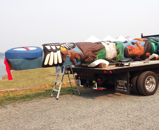
Lump carvers hand-carved this totem pole to raise public awareness and opposition to the exporting of fossil fuels. Photo/Kim Kalliber
Lump carvers hand-carved this totem pole to raise public awareness and opposition to the exporting of fossil fuels.
Photo/Kim Kalliber


“The totem pole design includes an eagle, a buffalo, two badgers, two drummers with a buffalo skull and drum, and a turtle with a lizard on each side. These are symbols of their culture,” explains James.  “These people want everyone to know that they love the earth, they love their mother, and they want us to help them protect our part of the earth. “

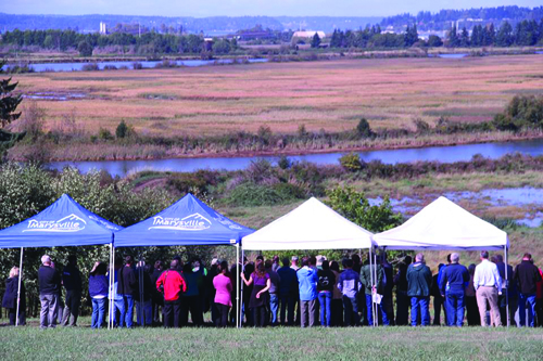
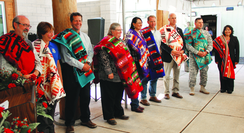
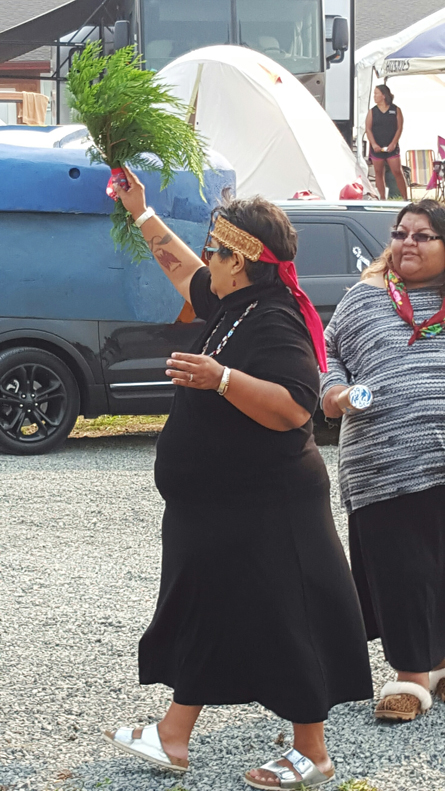
On August 23, the Tulalip Tribes welcomed the totem pole and guests with songs and blessings. Tribal Chairman Mel Sheldon opened the ceremony and tribal member Caroline Moses led a blessing song for the totem pole.


Tulalip tribal member Caroline Moses blesses the totem pole. Photo/Kim Kalliber
Tulalip tribal member Carolyn Moses blesses the totem pole.
Photo/Kim Kalliber


“The salmon are already dying in the river because of the high temperature. The spawning grounds are poisoned.  They [coal companies] have yet to feel the repercussions of that. They are walking away with their hands slapped. These ports, Cherry Point, Port of Morrow, we’re talking about 153 million tons [of coal] annually coming into the Pacific Northwest, loaded with arsenic and mercury,” said James to the group of tribal and community members gathered at the shores of Tulalip Bay. “We’re saying no; we’re united. We’re happy to be at Tulalip because Tulalip is a leader tribe.”

James went on to speak about the united effort to defeat these fossil fuel export projects, saying that, “nobody hears us, because the media doesn’t come to Northern Cheyenne.” The totem pole journey plays an important role in bringing people together, creating new alliances, and empowering the public with information about fossil fuels and the damage they are causing the environment.


Jewell James and Tulalip Tribal Chairman Mel Sheldon Photo/Niki Cleary, Tulalip News
Jewell James and Tulalip Tribal Chairman Mel Sheldon
Photo/Niki Cleary, Tulalip News


“Pope Francis came out with a statement last year that they were wrong and they should have taught the people how to love the earth, not destroy it.  They made a mistake. What we need to do as tribal people is to make sure that they live up to the words they put out publicly.  We’re calling on everybody to join together. We need to get together because the Earth’s dying. July was the hottest recorded July in recorded history. The Earth is burning. Global warming is a reality and they’re syphoning our rivers dry. Our salmon, our fish, and everything else that depend upon it is dying around us.

“We say it simply, love the Earth. That’s the message that we’re bringing to Northern Cheyenne in unison with us.”


Power Plants on Indian Reservations Get No Break on Emissions Rules

Four of the dirtiest plants, which sit on Native American soil, were expecting more lenient goals under the Clean Power Plan, but the EPA shifted gears.

By Naveena Sadasivam, Insideclimate News

The Navajo Generating Station is one of the country's dirtiest power plants. Credit: Wikipedia.
The Navajo Generating Station is one of the country’s dirtiest power plants. Credit: Wikipedia.

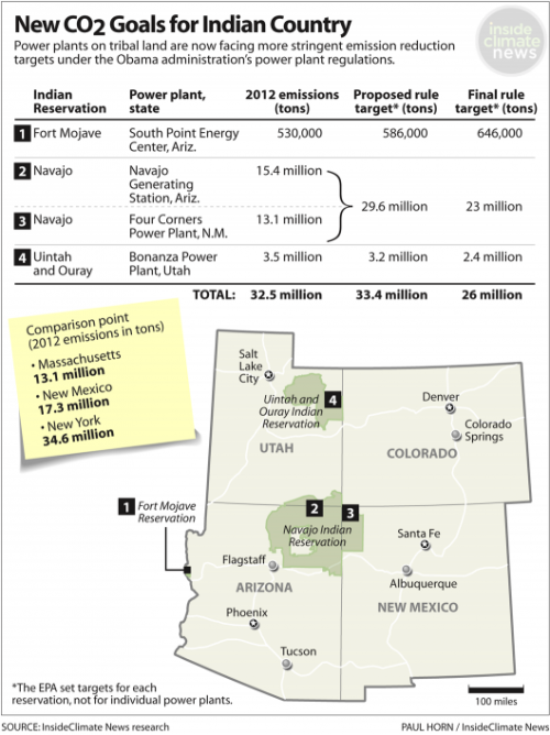
Four Western power plants that emit more carbon dioxide than the 20 fossil-fuel-fired plants in Massachusetts thought they would be getting a break under the Obama administration’s new carbon regulations––until the final rule ended up treating them just like all the other plants in the country.

The plants are located on Native American reservations, and under an earlier proposal, they were required to reduce emissions by less than 5 percent. But the final version of the rule, released earlier this month, has set a reduction target of about 20 percent.

A majority of the reductions are to come from two mammoth coal plants on the Navajo reservation in Arizona and New Mexico—the Navajo Generating Station and the Four Corners Power Plant. They provide power to half a million homes and have been pinpointed by the Environmental Protection Agency as a major source of pollution––and a cause for reduced visibility in the Grand Canyon.

These two plants alone emit more than 28 million tons of carbon dioxide each year, triple the emissions from facilities in Washington state, fueling a vicious cycle of drought and worsening climate change. The two other power plants are on the Fort Mojave Reservation in Arizona and the Uintah and Ouray Indian Reservation in Utah.

Environmental groups have charged  that the Navajo plants are responsible for premature deaths, hundreds of asthma attacks and hundreds of millions of dollars of annual health costs. The plants, which are owned by public utilities and the federal government, export a majority of the power out of the reservation to serve homes and businesses as far away as Las Vegas and help deliver Arizona’s share of the Colorado River water to Tucson and Phoenix. Meanwhile, a third of Navajo Nation residents remain without electricity in their homes.

IndianReservationPowerPlants1058px

Tribal leaders contend that power plants on Indian land deserve special consideration.

“The Navajo Nation is a uniquely disadvantaged people and their unique situation justified some accommodation,” Ben Shelly, president of the Navajo Nation, wrote in a letter to the EPA. He contends that the region’s underdeveloped economy, high unemployment rates and reliance on coal are the result of policies enacted by the federal government over several decades. If the coal plants decrease power production to meet emissions targets, Navajos will lose jobs and its  government will receive less revenue, he said.

Many local groups, however, disagree.

“I don’t think we need special treatment,” said Colleen Cooley of the grassroots nonprofit Diné CARE. “We should be held to the same standards as the rest of the country.” (Diné means “the people” in Navajo, and CARE is an abbreviation for Citizens Against Ruining our Environment.)

Cooley’s Diné CARE and other grassroots groups say the Navajo leaders are not serving the best interest of the community. The Navajo lands have been mined for coal and uranium for decades, Cooley said, resulting in contamination of water sources and air pollution. She said it’s time to shift to new, less damaging power sources such as wind and solar.

The Obama administration’s carbon regulations for power plants aim to reduce emissions nationwide 32 percent by 2030 from 2005 levels. In its final version of the rule, the EPA set uniform standards for all fossil-fueled power plants in the country. A coal plant on tribal land is now expected to achieve the same emissions reductions as a coal plant in Kentucky or New York, a move that the EPA sees as more equitable. The result is that coal plants on tribal lands—and in coal heavy states such as Kentucky and West Virginia—are facing much more stringent targets than they expected.

The EPA has taken special efforts to ensure that the power plant rules don’t disproportionately affect minorities, including indigenous people. Because dirty power plants often exist in low-income communities, the EPA has laid out tools to assess how changes to the operation of the plants will affect emission levels in neighborhoods nearby. The EPA will also be assessing compliance plans to ensure the regulations do not increase air pollution in those communities.

The tribes do not have an ownership stake in any of the facilities, but they are allowed to coordinate a plan to reduce emissions while minimizing the impact on their economies. Tribes that want to submit a compliance plan must first apply for treatment as a state. If the EPA doesn’t approve, or the tribes decide not to submit a plan, the EPA will impose one.

EPA Causes Massive Waste Spill, Hurting Navajo Nation

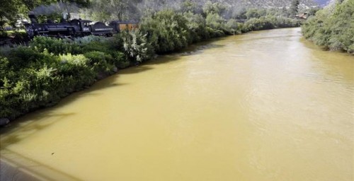
 animas river

By Daniel Davis, Townhall.com

Durango, Colorado declared a state of emergency yesterday after the EPA accidentally contaminated a local river with 3 million gallons of waste. The Animas River has turned orange, and residents living along its banks have been warned to avoid it.

The accident began Wednesday last week when EPA workers accidentally leaked a local mine, releasing concentrated minerals into a stream. The mine had been abandoned for about 10 years, and ground water had accumulated inside it. EPA workers were there to clean up the mine. Now, the mine is leaking at 500 gallons per minute. It still hasn’t been contained, though workers are treating the nearby ponds where the minerals are leaking.

The EPA has tested the polluted water and reports arsenic levels at 300 times the normal level, and lead levels at 3,500 times the normal level. Both arsenic and lead pose significant dangers to humans when highly concentrated. The local sheriff has warned local residents to stay away from the river. The contaminants move along the river fairly quickly, they will not completely pass until the mine leak is plugged.

Many people who live along the Animas River depend on private wells for their water, but those are now threatened by the river’s pollution. The EPA is sending materials to these residents so that they can test their well water for cleanness.

The water pollution has flowed straight into the territory of the Navajo Nation, a semi-autonomous reservation Native American reservation spanning parts of northern Arizona, New Mexico, and southern Utah. The spill is already threatening the livelihoods of many Navajo residents, and the nation has declared its own state of emergency. It even looks to be preparing for a lawsuit against the EPA — the Navajo Nation Commission on Emergency Management has directed the tribe’s Attorney General to assemble a legal team to address the grievances of local residents:


Navajo Nation Council Speaker LoRenzo Bates told the Daily Times that residents were concerned about drinking water safety, river access, water for livestock and crops, and the possibility of compensation for failed crops. With irrigation canals shut off, many farmers are concerned about their next step, Bates said.

“If these farmers don’t get water in the next week, they’ll lose their crops,” he said.


The plume of orange waste has already reached three states, and is expected to reach a fourth by Wednesday. As USA Today reports:


Mustard-colored water flowed this week into Cement Creek, a tributary that runs through Silverton [Colorado] and into the Animas River. In New Mexico, the plume of pollution entered Aztec early Saturday morning and Farmington later that morning. Officials said they expected it to reach the Utah border on Monday and Lake Powell, in Arizona, late Wednesday.


New Mexico Gov. Susana Martinez toured the damage in Farmington, NM over the weekend. She was stunned by the disaster:


“The magnitude of it, you can’t even describe it,” she said, CNN affiliate KRQE reported. “It’s like when I flew over the fires, your mind sees something it’s not ready or adjusted to see.”


Equally stunning was the EPA’s slow response in notifying states of the disaster. New Mexico officials got their first word of the disaster from Native American officials. By the time they heard from EPA officials, it was 24 hours after the spill had begun. Gov. Martinez commented:


“It’s completely irresponsible for the EPA not to have informed New Mexico immediately.”

Drought, Water Quality on Many Minds

“Being Frank”

By Lorraine Loomis, Chair, Northwest Indian Fisheries Commission


Water – how much we have and how clean it should be – is on the minds of many these days as the drought rolls on in western Washington and state government remains stalled on updating decades-old water quality standards.

Tribal insistence on more restrictive salmon fisheries this year has turned out to be the right call as the hottest and driest summer we’ve ever seen continues, threatening salmon throughout western Washington at every stage of their life cycle.

With no snowpack, record warm weather and little rain, our rivers and streams are running low, slow and hot. That’s bad news for both hatchery and wild salmon, which depend on plenty of cool water for their survival.

Many returning adult salmon died last year before they could reach spawning grounds or a hatchery, while thousands of out-migrating young salmon died before they could reach the ocean. The deaths of those salmon will be felt by all fishermen several years from now when fewer fish return.

Water temperatures 70 degrees and higher can be lethal to salmon. Many streams already have reached those temperatures with a lot of summer left. Warm water can also create a thermal barrier that prevents salmon from reaching hatcheries and spawning grounds. In addition, salmon are more susceptible to diseases when water temperatures are high.

Salmon are getting some relief from tribal and state hatcheries that use cooler groundwater for incubating and rearing fish. These hatcheries are providing sanctuaries to help salmon survive the drought and fulfilling their role as gene banks to preserve salmon for the future.

The outlook for many tribal fisheries is growing steadily darker as week after week slips by with no improvement in weather conditions. We hope enough salmon will return to our fishing grounds so that we can feed our families and preserve our cultures and communities.

It wasn’t easy for the tribes to convince the state co-managers that tougher fishing regulations were needed this year to protect salmon. In fact, the Puget Sound sport-fishing industry was prodding the Washington Department of Fish and Wildlife to expand fisheries this summer. But salmon management is not a popularity contest and the effects of our drought are getting worse.

The treaty tribes in western Washington will continue to insist on the highest level of responsible fisheries management and hatchery operations to ensure all of our children have a future that includes salmon.

On the water quality front, the state legislature adjourned a triple overtime session in June without approving Gov. Jay Inslee’s proposal for new water quality standards as part of a statewide toxics reduction program.

State water quality standards already are more than 40 years old. The state admits that current standards don’t adequately protect any of us, especially those of us who eat a lot of fish and shellfish. The state has missed every deadline to update the standards as required by the federal Clean Water Act.

Inslee’s toxics reduction program is a good idea. It’s a lot easier and cheaper to prevent poisons from ever getting into our waters than to clean them up afterwards. But to be effective, such a program must first be based in a strong rule of law that will drive the compliance and innovation needed to meet those standards.

The governor is expected to propose a new set of water quality standards in early August. If not, the U.S. Environmental Protection Agency will step in to help.

It is important to remember that all natural resources are connected. Water quantity and quality are two sides of the same coin. Both are fundamental to the health of people and salmon.

Protecting and restoring salmon habitat improves the overall health of our watersheds, making them more resistant to drought and able to bounce back more quickly from its effects.

To truly protect our water quality and quantity – and to protect and restore the salmon resource – we must continue to work together to restore salmon habitat. At the same time, we should develop strong rules that can support a statewide toxics reduction program with realistic, truly protective water quality standards that are implemented over time.

As salmon vanish in the dry Pacific Northwest, so does Native heritage

By Darryl Fears, Washington Post 


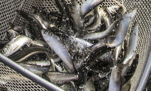
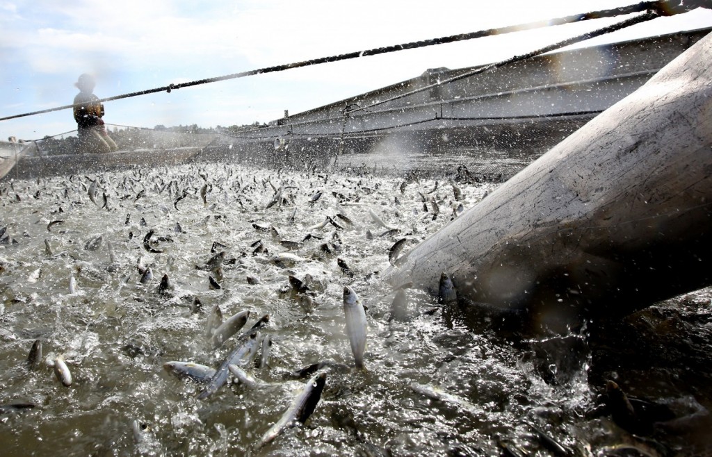
Young salmon called "smolts" are loaded into a floating net suspended on a barge at Mare Island, Calif. (Rich Pedroncelli/AP)
Young salmon called “smolts” are loaded into a floating net suspended on a barge at Mare Island, Calif. (Rich Pedroncelli/AP)


As a drought tightens its grip on the Pacific Northwest, burning away mountain snow and warming rivers, state officials and Native American tribes are becoming increasingly worried that one of the region’s most precious resources — wild salmon — might disappear.

Native Americans, who for centuries have relied on salmon for food and ceremonial rituals, say the area’s five species of salmon have been declining for years, but the current threat is worse than anything they have seen.

“I grew up always having salmon,” said Lorraine Loomis, fisheries director for the Swinomish Indian Tribal Community, whose culture is so intertwined with the migrating fish that they’re called the “People of the Salmon.” Salmon feasts once marked every phase of life on the reservation north of Seattle — naming ceremonies, weddings, funerals, memorials to the dead. Now they are few, she said.

“We’re very worried,” said N. Kathryn Brigham, chair of the Columbia River Inter-Tribal Fish Commission in Portland, Ore., which helps manage fisheries for the Yakama Nation and the Warm Springs, Nez Perce and the Umatilla tribes in Oregon, Washington and Idaho.

An estimated quarter-million salmon, more than half of the spring spawning run up the Columbia River, perished, probably because of a disease that thrives in warm water and causes gill rot, officials said. Normally cool streams in the river basin are 13 degrees warmer than the 60 degrees preferred by salmon, Brigham said.


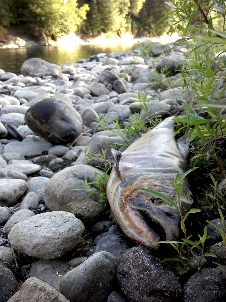
The carcass of a Chinook salmon, an apparent victim of high water temperature, is shown on the bank of the Clackamas River in Oregon. Oregon wildlife officials are restricting fishing on most of the state’s rivers in an unprecedented effort to aid fish populations dying off from high water temperatures as the state suffers ongoing drought conditions. (Reuters/Rick Swart/Oregon Department of Fish and Wildlife)


Salmon in the Northwest come in a variety — chinook, pink, coho, sockeye and chum — and that diversity has helped them survive for eons. When they hatch, some babies stay in place to eat and grow before migrating to the Pacific Ocean. Others swim to the ocean right away.

Adults stay in the Pacific for three to seven years before returning to streams where they hatched by swimming through Puget Sound in Washington or up the Columbia River, which runs from Alberta, Canada, to Oregon.

But as the climate warms, more salmon are starting to move farther north to Canada, experts say. Swimming to cooler waters in the north signals a major shift in behavior for the fish, and public officials are watching the trend with dread.

In addition to their significance to Native American communities, the salmon are worth more than $1 billion annually to each state’s sport fishing and tourism industries, which support tens of thousands of jobs.

Oregon and Washington officials recently closed dozens of recreational and commercial fishing spots. The U.S. Fish and Wildlife Service trucked 160,000 salmon 100 miles from a hatchery in central Oregon to a cooler part of the Columbia River.

As more fish vanish, the Swinomish, whose reservation skirts five bays, rely on handouts from the state and tribal councils. They accept 5,000 to 10,000 pieces per year to freeze, Loomis said.

“There’s just no water,” she said. “The glaciers are almost gone. The snow in the mountains is not good.” Even if salmon survive, but in tiny, remnant populations, “we won’t be able to sustain ourselves.”


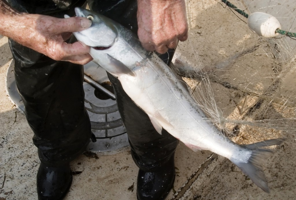
Commercial fisherman Les Clark pulls a sockeye or blueback salmon from his net while fishing on the Columbia River near Skamania, Wash. More than a quarter million sockeye salmon returning from the ocean to spawn are either dead or dying in the Columbia River and its tributaries. (Gordon King/Yakima Herald-Republic via AP)


Possible extinction


Off the coast of Oregon, wild chinook salmon are gathering for a fall spawning run up the Columbia, but experts say there’s a good chance many will never arrive to lay eggs in the streams and brooks where they hatched several years ago.

Besides facing long-standing hurdles such as dams, the fish now will encounter a large patch of warming water. U.S. Fish and Wildlife Service biologist Rich Johnson said the cooler ocean water probably will signal to the salmon that it’s okay to migrate up the warmer Columbia.

Earlier this year, clusters of dead and dying sockeye salmon were discovered in Oregon’s Lower Deschutes River, a Columbia tributary. Officials counted at least 100 fish but speculated that scavengers ate dozens more.

Scientists fear the chinook will suffer the sockeye’s fate. Die-offs mean that fewer eggs will hatch and hatchlings might not survive the warm water.

“The bleakest, most dire outcome is if this drought is sustained for a couple more years like California,” said Greg McMillan, science and conservation director for Oregon’s Deschutes River Alliance. Some populations “could go extinct,” he said.

But wild salmon have an array of survival tools. The species do not all migrate at the same time, and their hatchlings do not all behave the same. Some remain in shallow streams two years after hatching, while others head for the Pacific.

$500,000 grant for Tribal Heritage Project to be used at Grand Canyon’s Desert View

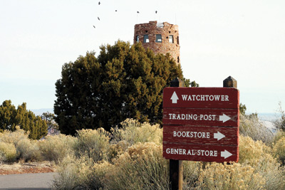
Grand Canyon National Park’s Desert View Watchtower and overlook area. Loretta Yerian/WGCN

By Grand Canyon News

GRAND CANYON, Ariz. – ArtPlace America recently announced that the American Indian Alaska Native Tourism Association (AIANTA), on behalf of the tribal heritage project partnership, received a grant of $500,000 to further arts and culture at Desert View inGrand Canyon National Park.

The grant will transform Desert View into a place to celebrate, share, and learn about inter-tribal cultural heritage.

AIANTA, along with Grand Canyon National Park and the park’s Inter-tribal Advisory Council (ItAC), will specifically use the grant to preserve murals inside the historic Watchtower, continue the Cultural Demonstration Series, and develop inter-tribal tourism opportunities.

In addition to ArtPlace America and AIANTA, Grand Canyon Association and the Bureau of Indian Affairs have partnered with Grand Canyon National Park on the reinvigoration of Desert View.

A signature project for next year’s National Park Service Centennial, the revival of Desert View as a cultural heritage site will provide opportunities for the public to connect with Grand Canyon’s traditionally associated tribes.

This transformation also ensures that future generations of tribal members and visitors will have an opportunity to make and share meaningful experiences and stories.

“This project re-envisions how visitors experience Desert View and the entire park and will lead us and the NPS into the next century. We are grateful for the support of ArtPlace America and the American Indian Alaska Native Tourism Association and the hard work of our Inter-tribal Advisory Council,” said Park Superintendent Dave Uberuaga.

Grand Canyon’s ItAC, established in 2013, is composed of representatives from the park’s 11 traditionally associated tribes who collaborate with the NPS on issues that affect each of the tribes and the park. Those tribes-Hopi, Navajo, Zuni, Havasupai, Hualapai, Yavapai-Apache, and five bands of Southern Paiute represented by the Kaibab Paiute-work with the park on programs such as youth development, tribal tourism opportunities and cultural demonstrations.

One of the programs, the Ancestral Lands Conservation Corps, supported by the NPS Washington Office of Youth Programs, employed 10 Navajo and Hopi students for 12 to 22 weeks. The hope is to develop the program further to engage youth from the traditionally associated tribes.

Working with Arizona Conservation Corps, the crew worked on multiple projects throughout Grand Canyon, ranging from trail maintenance to creating interpretive programs, as part of the ongoing changes at Desert View.

The Desert View area has been used as a gathering place for thousands of years. Visitors can see a glimpse of the ancient past at the Tusayan Ruin and Museum. Architect Mary Colter modeled Desert View’s centerpiece, the Watchtower, after the architecture of the Ancestral Puebloan people of the Colorado Plateau.

Today Desert View represents the physical and cultural gateway from Grand Canyon National Park to the Navajo and Hopi reservations.

Desert View is the eastern entrance into Grand Canyon National Park. It is located on the South Rim approximately 45 minutes east of Grand Canyon Village. To plan your visit to Desert View, go to www.nps.gov/grca/planyourvisit/placestogo.

For more about ArtPlace America visit www.artplacearmerica.org.

To see some of the projects from the Arizona Conservation Corps, check out www.azcorps.org.

California Indian Tribe Pursues Rights to Groundwater

Photo © Brent Stirton/Reportage by Getty Images for Circle of BlueA groundwater recharge facility for the Coachella Valley adds water imported from the Colorado River to the valley’s main aquifer and prevents the land from sinking and damaging the surrounding infrastructure.
Photo © Brent Stirton/Reportage by Getty Images for Circle of Blue
A groundwater recharge facility for the Coachella Valley adds water imported from the Colorado River to the valley’s main aquifer and prevents the land from sinking and damaging the surrounding infrastructure.

A court test of federal water law by the Agua Caliente Band of Cahuilla Indians has implications for the American West.

By Brett Walton, Circle of Blue

As California implements a landmark law to balance demand for groundwater with available supplies, an Indian tribe’s lawsuit in federal court has the potential to add new layers of complexity to managing a prized resource that is in short supply during California’s worst ever drought.

The Agua Caliente Band of Cahuilla Indians filed the suit on May 14, 2013 against the Coachella Valley Water District and the Desert Water Agency, two water suppliers in the tribe’s southern California desert region near Palm Springs. The case, straightforward in its goals, addresses two primary concerns: halting groundwater levels that have declined at an average rate of more than one meter per year since 2000, and stemming pollution in the groundwater beneath the 12,545-hectare (31,000-acre) reservation.

The Agua Caliente complaint reflects the growing willingness of Indian tribes across the American West to pursue, by court action or negotiated settlements, clear legal recognition of water rights that are held in trust by the U.S. government. The flexing of tribal legal muscle, which occurred first for surface water rights in the 1980s, has now expanded to seeking more authority over the use of groundwater. The result of these actions is that a new era of water management in the West is taking shape, one in which the old brokers — the cities, counties, and irrigation districts — will have to make room for another seat at the table.

Just like the tribal lawsuit, California’s 2014 law to fortify supplies and improve distribution of groundwater was prompted by rapidly diminishing aquifers and inadequate authority by local or state officials to curtail indiscriminate use. The convergence of the new state law and the federal lawsuit, along with helping to clarify who in California has access to and control of groundwater, has other wide-ranging implications. The Agua Caliente case could be a model for tribes in California that seek greater influence in water management decisions. And the tribe’s suit could set a precedent for how groundwater rights for Indian tribes are interpreted nationally.

Some see the case, now in the Ninth Circuit Court of Appeals, eventually reaching the U.S. Supreme Court. “The lawsuit is very significant,” Anecita Agustinez, tribal policy advisor for the California Department of Water Resources, told Circle of Blue, explaining that the case could prompt other tribes in California to file claims to groundwater. “I believe you can’t have groundwater management unless you have tribal participation. They live on significant rivers and watersheds.”

Tribes Pursue Water Rights

California is an important legal testing ground. The state is home to more than 100 federally recognized Indian tribes, from the Karuk reservation near Oregon to the Campo reservation on the Mexican border. The Agua Caliente is perhaps the first in the state to seek official recognition and quantification of its legal rights to groundwater. The tribe, by suing for its rights, wants a greater say in how water is managed in the valley.

“These practices are not acceptable for long-term health and viability of the Coachella Valley water supply,” Tribal Chairman Jeff Grubbe said in a statement in March, referring to the shrinking aquifer and decline in water quality. “We called out this detrimental practice and brought it to the attention of the water districts over and over for years simply to be ignored.”

The Lawsuit

The Agua Caliente lawsuit covers a few exacting points of jurisprudence — legal ownership, for example, of the space between soil particles that could be used for storing water underground. But the lawsuit makes two broad claims about water quantity and quality that could rebalance current management practices in the region and state.

The first claim is that the tribe has a federal reserved right to groundwater from two basins beneath the Coachella Valley. A federal reserved right was established in the seminal 1908 Winters decision in the U.S. Supreme Court, which found that the U.S. government, by establishing a reservation, implicitly set aside enough water for the tribe to make a living from the land. On March 20, 2015, the U.S. District Court of the Central District of California ruled that the Agua Caliente do have a reserved right to groundwater. An appeal of that ruling is being heard by the Ninth Circuit.

The second broad claim is that the valley’s two water agencies — Coachella Valley Water District and Desert Water Agency — are polluting the aquifer with imported Colorado River water, which is saltier than the local sources. The agencies pour Colorado River water, which is delivered by canals, into sandy-bottomed percolation basins throughout the valley to bolster sagging groundwater levels. The agencies acknowledge that the Colorado River supplies are saltier but do not admit that the practice of recharging the aquifer has increased its salinity. The Agua Caliente argue that their groundwater rights entitle them to water without added salts. This claim is being litigated in a second phase of the lawsuit.

A third phase of the lawsuit will consider numbers: How much groundwater do the Agua Caliente own? Do they have a right to water of a certain quality? What should the standard be? Only phase one — the determination that the tribe does indeed have a right to groundwater – has been completed by the district court.

Local and State Implications

The lawsuit makes the Coachella Valley water agencies nervous. The changes that are in store if the Agua Caliente are granted rights to a significant portion of the aquifer could be substantial.

Photo © Brent Stirton/Reportage by Getty Images for Circle of BlueChris Thomas, 44, works as a zanjero, or ditchrider, who regulates waterflow to agriculture in the Coachella Valley. Zanjeros deliver irrigated water to farmers and other users, adjusting flow according to calculations from the Coachella Valley Water District Authority. Click image to enlarge.
Photo © Brent Stirton/Reportage by Getty Images for Circle of Blue
Chris Thomas, 44, works as a zanjero, or ditchrider, who regulates waterflow to agriculture in the Coachella Valley. Zanjeros deliver irrigated water to farmers and other users, adjusting flow according to calculations from the Coachella Valley Water District Authority. 

“There’s a great deal of speculation,” Katie Ruark, spokeswoman for Desert Water Agency, told Circle of Blue. “The tribe hasn’t said what they plan to do with their rights.” Ruark mentioned water rate increases — if the agency was forced to buy back water from the tribe — as one potential effect. Then there is the tribe’s well-documented displeasure with the decline in groundwater levels, which could prompt a reduction in pumping.

Agua Caliente’s spokeswoman Kate Anderson referred Circle of Blue to the tribe’s website and did not respond to follow up questions about the tribe’s role in managing the region’s aquifers and what changes it would like to see.

The lawsuit coincides with a transition in California’s groundwater practices. The state’s groundwater reserves plunged to record lows in the last four years of drought. Little snowmelt or rainfall percolated into the ground while prodigious amounts of water were pumped out to sustain the country’s largest agricultural economy. Thousands of rural wells have gone dry.

Farmers and cities in most of the state were allowed to pump without limits because there was no authority to regulate groundwater. That changed last September when Gov. Jerry Brown signed the Sustainable Groundwater Management Act, which requires the state’s most important groundwater basins to form management agencies by 2017 and align water withdrawals with water availability by 2040.

Anecita Agustinez, the state’s tribal policy advisor for water, said that how the tribes fit into the evolving management picture is still being discussed. Tribes are not allowed to form their own groundwater management agency, but they can participate in a joint effort with cities, farm districts, and other local agencies. She called the integration of tribal authority a “potential hurdle.”

“It’s all very new,” Agustinez said. “We’re working on guidelines now.” She said that the documents that local agencies must fill out when they form a management body asks whether they consulted with tribes.

Integrating tribal claims represent a new demand in the system and could displace existing water uses, not just for California but for all western states, according to Steve Greetham, chief general counsel for the Chickasaw Nation, in Oklahoma. “It’s a challenge when looking at potentially thousands of property owners who have a stake in the outcome,” he told Circle of Blue.

In Arizona, which has settled more Indian water claims than any other state, the tribes have emerged as co-managers and essential partners with the state’s cities and water agencies.

If the Agua Caliente are granted rights to a certain quantity and quality of water, as they seek in the lawsuit, they will force the issue in the Coachella Valley and potentially open a door for other groundwater claims in California.

Federal Implications

How a groundwater right would work in practice in California, where “pump as you please” is the current operating principle, is an unresolved question. Courts elsewhere have faced the same issue and have ruled in favor of tribes. In the last 15 years, the Arizona and Montana Supreme Courts, and a U.S. district court in Washington State determined that Indian tribes do have rights to groundwater based on the reserved rights doctrine. The U.S. district court decision in the Agua Caliente case follows that precedent.

“There’s a trend toward the courts finding that tribes have a right to groundwater,” Ryan Smith, a lawyer at Brownstein, Hyatt, Farber, and Schreck who specializes in Indian law, told Circle of Blue.

The U.S. Supreme Court has not heard a case pertaining to groundwater for tribes. Though it ruled in 1976, in Cappaert v. United States, that groundwater is a reserved right, the nation’s highest court has not set a national standard for applying the reserved right doctrine to groundwater. Without a clear national definition, each state divides its groundwater for tribes in a different way. Arizona, for instance, says that tribes have groundwater rights only when surface water is insufficient for the reservation.

The lack of a standard has “muddied the waters” at the state level, Greetham asserted. “As a tribal advocate, I think that’s terrible,” Greetham told Circle of Blue. “[The states] don’t all apply the doctrine with the same rigor.”

The variability is one reason that the U.S. Supreme Court could take up the Agua Caliente case. Roderick Walston, the attorney representing Desert Water Agency, told Circle of Blue he thinks that the losing side will appeal to the U.S. Supreme Court and there is a good chance the justices will review it. Smith agreed, saying that the court might want to conclusively settle the matter.

Others argue that the precedent set by the lower courts is compelling evidence that a groundwater right does exist and that any U.S. Supreme Court decision would refine the definition of how to apply it.

“I think there is a certain level of optimism on the part of non-tribal actors that the Supreme Court will address Winters rights and more narrowly define them,” Greetham said. “Non-tribal actors are fooling themselves if they think the Supreme Court will issue more restrictive rights.”

The legal right to groundwater, in other words, is likely to be upheld. For California agencies, it is another factor to consider as they follow the long path toward groundwater sustainability.

Restored, opened habitat leads to record run of coho from Goldsborough Creek

By Northwest Indian Fisheries Commission 

Scott Steltzner, biologist for the Squaxin Island Tribe, inspects a newly constructed logjam in 2013.


SHELTON – The combination of dam removal and aggressive habitat restoration has meant record runs of juvenile coho salmon in Goldsborough Creek for 2015.

This year’s run of 113,000 juvenile counted by the Squaxin Island Tribe continues a strong trend of increasing the numbers of juvenile coho leaving the Goldsborough watershed. The previous record was 61,000 coho.

Almost 15 year ago the U.S. Army Corps of Engineers removed a dam on Goldsborough, opening over 30 miles of near intact habitat to salmon. Since then, the Squaxin Island Tribe has worked with community partners to further improve the habitat through restoration projects throughout the watershed.

“The lesson of Goldsborough Creek is pretty basic: If you give salmon habitat, they’re going to succeed,” said Andy Whitener, natural resources director for the Squaxin Island Tribe.


For example, a couple of years ago, the tribe worked with the South Puget Sound Salmon Enhancement Group, Simpson Lumber, the Green Diamond Resource Company and Miles Sand and Gravel to restore habitat along the creek. The project partners added wood structures to the stream, which give both juvenile and adult salmon places to feed and hide.

A year earlier, the Tribe and the enhancement group replaced undersized culverts just upstream from the old dam site that were blocking a tributary to Goldsborough. The project opened nearly a mile of new spawning and rearing habitat that had not seen salmon in over 100 years.

“These projects, coupled with dam removal, reversed a negative trend for coho on Goldsborough,” Whitener said.

The tribe has operated at least one smolt trap on the creek since dam removal to count out-going salmon migrants. Smolt traps are safe and effective devices for counting young fish. Smolt comes from the word “smoltification” which is the term used to describe the physiological changes that young salmon undergo while in freshwater, just before migrating downstream and entering saltwater.

“By using the trap every year, we’re getting a great picture of the benefits salmon see from good habitat,” said Daniel Kuntz, fisheries biologist for the tribe.

Most importantly to coho salmon, the removal of the dam opened up access to a series of wetlands where juvenile salmon could rear. Unlike most other species of salmon, coho spend an additional year in freshwater before heading out to sea.

The Tribe along with WDFW also conducts yearly adult spawning surveys on Goldsborough Creek above the former dam site. “We get a good look at these salmon at both ends of their life-cycle – as they leave as juveniles and as their returning as spawning adults,” Kuntz said.

“The success salmon have seen since we’ve begun restoring the watershed shows directly how much salmon really do depend on habitat,” said Whitener. “

Puget Sound cities activate drought plans as river levels drop

150728_water_shortage_660


Source: KOMO News


SEATTLE – Several Puget Sound cities are one step closer to water restrictions as the region’s record-setting hot, dry summer continues.

Seattle, Everett and Tacoma are all activating the first phase of their drought and water shortage plans, starting Tuesday. Those cities supply about two-thirds of all of the water used by Puget Sound residents and businesses – about 180 million gallons a day in the summer.

The conservation measures aren’t as drastic as in California, where people in some municipalities can’t water their lawns or wash their cars.

But city officials agree it is now imperative to begin with some voluntary steps, with local rivers running at historically low levels – killing off the oxygen fish need to survive.

Each city’s plan is a little bit different – but the basics are the same in each case. Residents are being asked to:

• Water plants early or late in the day – before 8 a.m. or after 7 p.m. – to prevent evaporation.

• Water longer but less frequently – a good soaking lasts longer.

• Fix leaks on faucets and toilets to stop wasting water.

• Use a broom instead of a hose to clean off driveways or patios.

Right now, all of these ideas are voluntary, but it’s clear that will change if conditions get worse – as we head into another round of hot weather this week.

Sockeye salmon suffer infections in warm Columbia River system

Columnaris lesions mar the gills of a sockeye salmon that was moving up the Columbia River in July 2015.


By Rich Landers, The Spokesman-Review

FISHING — “Catastrophic” is a word that’s being used as scientists begin to unravel the mystery of why at least 200,000 sockeye that moved over Bonneville Dam have not made it to McNary Dam fish ladders in this summer’s huge salmon runs.

The sockeye woes may explain why dozens if not hundreds of 5- to 12-foot-long decades old sturgeon stuffed with sockeye are going belly up in the Columbia between the Tri-Cities and The Dalles.

The Columbia system is plagued with high temperatures and low flows. This is bad news for native fish that need cool water.

Fish managers have enacted fishing restrictions in some areas, but otherwise there isn’t a lot they can do about Mother Nature.

The photos above are of sockeye sampled last week at Bonneville Dam by state and federal scientists.  The first dead sockeyes were noticed at the dam around June 8. This week, the fish scientists were finding dead fish, both shad and sockeye, in the Bonneville Dam fish ladder.

At the Little White Salmon National Fish Hatchery, sockeye in rough shape were hanging out near the facility.

But the words scientists use to describe what’s going on are freakier than the photos.

A Washington Department of Fish and Wildlife biologist said this in an email to colleagues:

We have very bad news from the lower Columbia.  These pictures are just a little piece of the story.  The run is stalled, and the carnage is ugly, with conversion rates from Bonneville to Ice Harbor (for Snake River fish) 2-5%.  Temperatures in the John Day reservoir approach 24 degrees, so nothing’s getting through without suffering.  Looks like we’re going to lose the last 1/3rd to ½ of the run.

Fish that have passed the Snake are still moving upstream, but can’t get to into the tributaries.  The fish that have entered the Wenatchee aren’t passing Tumwater Dam to continue on to Lake Wenatchee, and there’s no cold-water refugia below the dam unless they retreat downstream about 15 km to Peshastin Creek, which is a great steelhead stream but has no holding water for thousands of sockeye.  Besides that, the flows are about half normal discharge, the snow’s all melted out of the cold-water source for Peshastin Creek, and they’re diverting water for irrigation, so it’s bound to heat up.  For fish that passed Tumwater early, many have piled into a small tributary called Chiwaukum Creek, but it’s about the same size as Peshastin.

The Okanagan fish can’t leave Wells with the US Okanogan at 28 degrees C, and the reservoir is nearly 18 degrees C already.  The rate of diseased and injured fish observed in the count windows at Wells seems to increase every day—lots of lamprey scars and descale, and we’re starting to see fungus and bacterial lesions.  I don’t think the estuary provides hospitable holding, with lamprey and pinnipeds; so, I’m not sure we can count on a fall resurgence of migrants.

A British Columbia scientist commenting on this email thread among scientists wrote this:

Catastrophic losses of this year’s exceptional returns of adult Sockeye Salmon have begun to occur in the Columbia River given the unprecedented severity of super-optimal temperatures and low flows encountered along their freshwater migration corridor…. It’s probably fair to surmise that we may lose the majority of the nearly 350,000 wild adult Sockeye destined for Canadian portions of the Okanagan if Wells Pool, where they are currently holding, warms to temperatures much greater than 18 degrees Celsius for an appreciable length of time. Regrettably, this is highly likely to occur as temperatures are currently at 17.5 degrees and increasing while the Okanagan River is well in excess of the upper thermal lethal temperature of 25 degrees.

As noted in an earlier bulletin, we are also maintaining a Somass Salmon and Climate Watch given poor environmental conditions for either migration in the Somass River or for holding at the head end of Alberni Inlet. Although some fish managed to access their lakes of origin at Great Central and Sproat in the past few days, conditions are still marginal for passage and stored water released from behind the Great Central Lake Dam to supplement flows to ease passage under high temperature conditions has now been exhausted just as we head into what is on average the driest weeks of the summer-fall interval.

It may be advisable for DFO communications to identify “talking points” and “spokespersons” very soon to get out in front of events that will likely generate intense media interest. I’ve worked on BC salmon populations for more than 40 years and cannot remember anything comparable to what were currently seeing unfold on the coast !