By Monica Brown, Tulalip Communications Department
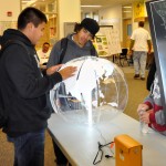
TULALIP, Washington – Heritage High School classrooms were set-up on the morning of December 13th, geared towards teaching students the many aspects of what a Geographic information system is and how to use it. GIS is a system for storing and manipulating geographical information on computers. Throughout the day students rotated on thirty-minute classroom sessions which covered software, planning, surveying/ground penetrating radar, natural resources, trivia and geocaching, which is basically a world-wide scavenger hunt using GPS technology. Students were given hands-on experience using a GPS outside and were able to navigate on-foot to set points through a GPS. GIS day was hosted by the Tulalip Data Services GIS team and Tulalip Tribes Natural Resources.
